
By: Stephen McCoy
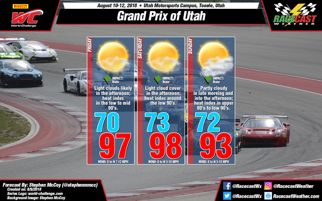
Conditions are looking to remain hot in this update for the Grand Prix of Utah at Utah Motorsports Campus. Be sure to stay hydrated as even though low dew point temperatures will be present for the region, heat index values will likely exceed 90 each day.
Not much has changed for the forecast on Friday as an upper level high pressure ridge is still expected to set up over the western United States, creating dry conditions and warming temperatures into the upper 90's. Clear to mostly sunny conditions are likely, though winds from the south in the mid levels could bring a small amount of moisture resulting in some light cloud cover in the afternoon.
Saturday is expected to be warmer than seen in the previous forecast as the upper level high pressure ridge was expected to weaken as it stretched and moved eastward. However in the most recent model runs the ridge instead remains mostly stationary at a constant geopotential height value, creating conditions consistent with those expected for Friday.
On Sunday, more moisture will likely enter the region by ways of southwesterly winds in the mid levels. As a result, expect partly cloudy conditions in the late morning and most of the afternoon. With the upper level high pressure ridge beginning to weaken as it stretches eastward, lower temperatures than the rest of the weekend are likely. However, with slightly higher dew point temperatures on Sunday, heat index values will be closer to the air temperature.


