
By Scott Martin.

Friday will be a nice and breezy day in southern Florida, with only a few clouds to filter out the sun at times. No rain is expected on this mostly clear day, and temperatures will warm into the lower 80s for the afternoon high, after starting off the morning in the lower 70s at 8:00 AM. Winds will be out of the east at 5-15 MPH, with gust up to 22 MPH possible at times.
Saturday's weather looks to be a lot better than first forecast on Tuesday... the cold front continues to lag back to the west and much of the day will actually be pretty decent and warm. We'll have more sun than clouds throughout the day, but there will be enough available moisture and instability for a very small chance of a passing shower or thunderstorm. Temperatures at 8:00 AM will start off in the lower 70s but will top out in the mid-80s for the afternoon high. Winds will steadily increase throughout the day, starting off at 5-10 MPH out of the southeast, and up to 15-20 MPH with gusts up to 25 MPH likely by afternoon. Chance of rain at this point is only 20%.
Saturday's weather looks to be a lot better than first forecast on Tuesday... the cold front continues to lag back to the west and much of the day will actually be pretty decent and warm. We'll have more sun than clouds throughout the day, but there will be enough available moisture and instability for a very small chance of a passing shower or thunderstorm. Temperatures at 8:00 AM will start off in the lower 70s but will top out in the mid-80s for the afternoon high. Winds will steadily increase throughout the day, starting off at 5-10 MPH out of the southeast, and up to 15-20 MPH with gusts up to 25 MPH likely by afternoon. Chance of rain at this point is only 20%.
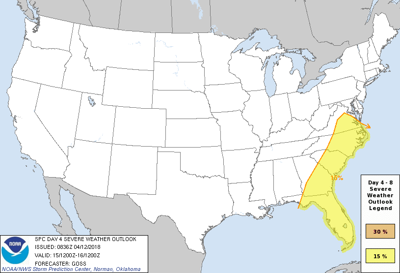
Rain and storms, some of which could be strong to severe, are likely on Sunday. As you can see in the image above, the Storm Prediction Center has all of the Atlantic Coast from Virginia down to the southern tip of Florida in a risk for severe storms for Sunday. The good news is that it looks like the main bulk of the storms will hold off until after racing is completed for the day. The bad news is that there is still a decent chance of rain and storms before that. The latest NAM-12k model run actually keeps the main line of storms out of the area until after nightfall, but a few scattered convective showers and storms could form out ahead of the line as conditions will be prime for storms. As of now, I'm going with a 30% chance of rain before 2:00 PM, then increasing to 50% after that as the more lift will be added to the atmosphere with the line getting closer. By 7:00 PM, rain and storms will be likely. Afternoon highs will be in the mid-80s. Winds will be gusty at 15-25 MPH out of the southeast, with gusts up to 35 MPH possible. STAY WEATHER AWARE. I'll have radar going by Saturday morning.


