
By Doug Schneider
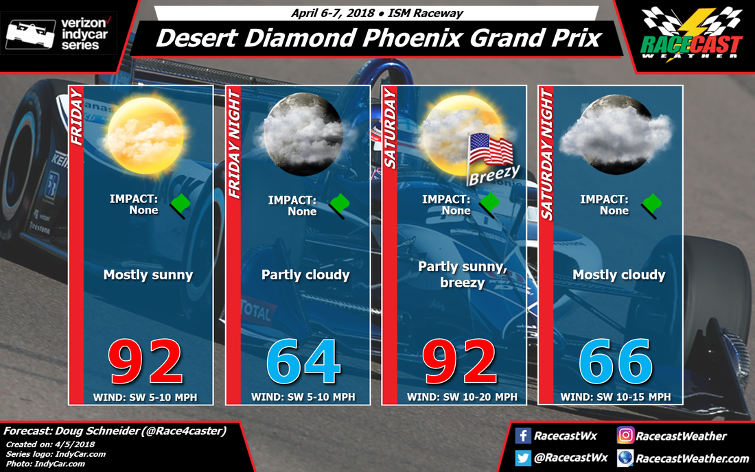
Today's forecast for the Desert Diamond Phoenix Grand Prix hasn't changed a whole lot from what I forecast on Monday. There continues to be a high pressure ridge over the desert southwest region today, and it will be nearly stationary or drifting slightly to the east over the weekend. Some high clouds will be crossing the Phoenix area at times on Friday and Saturday, but no rain is expected from them. Areas to the north of Phoenix that are at higher elevations may see a sprinkle, but nothing is expected at the track, which is on the south side of the city. Temperatures will be warmer than normal, with highs each day in the lower 90s. The normal high for Phoenix this time of year is around 84 degrees.
The main weather impact on the race will be the wind. Southwest winds on Saturday will be between 10 and 20 mph, with gusts to around 25 mph at times. During the race, winds will remain in the 10 to 15 mph range, but it should be less gusty than during the day. Temperatures at the start of the race will be in around 90, falling to the mid 80s by the checkered flag.
The main weather impact on the race will be the wind. Southwest winds on Saturday will be between 10 and 20 mph, with gusts to around 25 mph at times. During the race, winds will remain in the 10 to 15 mph range, but it should be less gusty than during the day. Temperatures at the start of the race will be in around 90, falling to the mid 80s by the checkered flag.


