
By Doug Schneider
Some slight changes were made for today's forecast update, and unfortunately, the chances that rain will impact qualifying on Saturday and Sunday are looking a little better today.
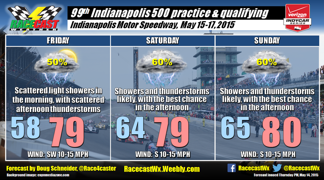
A warm front will be lifting northward across Indiana tonight. It may bring some light rain showers that will linger into Friday morning, but most of the shower activity should be located north and west of Indianapolis. Warmer and more humid air will follow the front on Friday, which will be favorable for afternoon showers and thunderstorms to develop. Coverage should be scattered, so it's a 50/50 chance that one of the showers will hit the track on Friday afternoon.
Moisture continues to increase over Indiana over the weekend, and with the very moist environment, showers and thunderstorms will be possible at any time. Saturday and Sunday look pretty similar to each other. While moisture will be plentiful through the atmosphere, there isn't a well-defined mechanism in the atmosphere that will be present to spark showers and thunderstorms, which makes it difficult to pin down the timing with any precision. However, I think that daytime heating and instability will result in the highest chances of showers and thunderstorms being in the afternoon and evening each day. It appears likely that some portion of qualifying will be affected by rain. Heavy downpours will be possible if the storms moves directly over the Speedway, but I do not expect severe thunderstorms at this time.
Our live Indy radar feed will be available through the weekend through the link at the top of the website, and I'll have updates through the weekend at my Twitter account - @Race4caster.


