By Doug Schneider
Showers are moving across the Toronto area this morning. Here's a look at the radar at 8:30 am:
Showers are moving across the Toronto area this morning. Here's a look at the radar at 8:30 am:
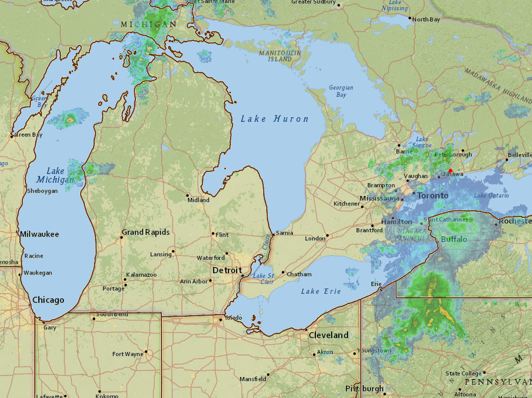
The rain this morning may last about an hour or so, then there will be a long dry period for most of the late morning and early afternoon. Notice the showers over Lake Michigan this morning. These are located along a cold front that will be tracking east through the day. While there isn't much activity there now, showers and thunderstorms are expected to increase as it moves across Michigan and southern Ontario. This satellite image of water vapor shows the bigger picture of what's happening today and tomorrow:
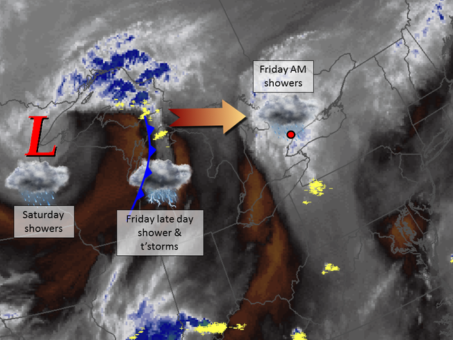
The white and blue colors indicate areas of higher moisture content, while brown indicates drier air. There is a good amount of moisture over Ontario this morning, then over Lake Michigan we see the cold front with some lightning strikes (yellow), The activity along the cold front is expected to reach CTMP late this afternoon. It could arrive as early as 4 pm, but I think the most likely time of arrival is around 6 pm. Qualifying for CTSC is between 5:10 pm and 5:55 pm, so it could be close as to whether it will be wet or dry. The total amount of rainfall from this morning through this evening will be between a quarter and a half inch. If you're at the track, stay aware of the weather and know where to find shelter when thunderstorms are nearby. You can use our radar link at the top of the page to keep track of what's coming. The movement of storms will be from west to east.
In the water vapor image, you can see an upper level low pressure system spinning counter-clockwise, centered over the western tip of Lake Superior. That is what will bring showers to CTMP on Saturday. Once the cold front moves through tonight, there will be a break in the rain until the upper level low moves overhead, which is expected to occur tomorrow. There could be showers any time of the day, but I expect that most of it will come in the afternoon when a little heating will help add some instability. The amount of rain on Saturday should be less than today, maybe around a tenth of an inch.
Sunday still looks nice as the upper low tracks east and drier air builds in behind it. Expect partly cloudy skies and highs in the upper 70s.
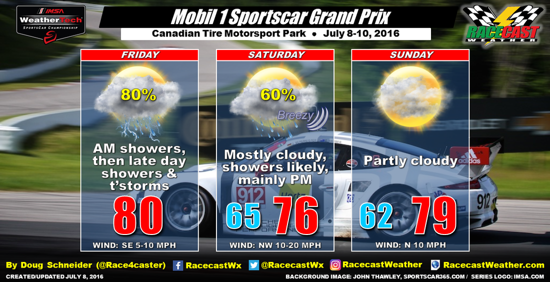
Here the updated forecast graphic:
In the water vapor image, you can see an upper level low pressure system spinning counter-clockwise, centered over the western tip of Lake Superior. That is what will bring showers to CTMP on Saturday. Once the cold front moves through tonight, there will be a break in the rain until the upper level low moves overhead, which is expected to occur tomorrow. There could be showers any time of the day, but I expect that most of it will come in the afternoon when a little heating will help add some instability. The amount of rain on Saturday should be less than today, maybe around a tenth of an inch.
Sunday still looks nice as the upper low tracks east and drier air builds in behind it. Expect partly cloudy skies and highs in the upper 70s.
Here the updated forecast graphic: