
By: Stephen McCoy - @stephenmmcc
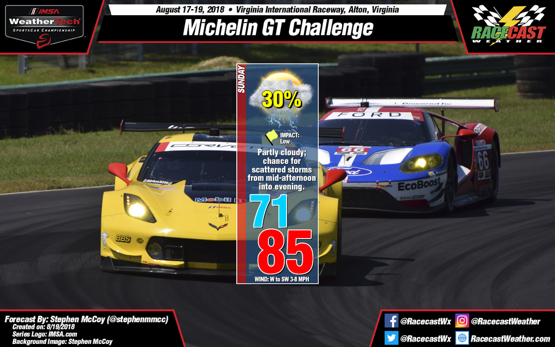
Not much has changed for Sunday's forecast since yesterday for the Michelin GT Challenge at VIRginia International Raceway. Upper level winds are expected to return to a regular zonal flow, with westerly winds bringing drier air aloft to the region. Winds in the mid to lower levels will transport moisture from the west to southwest, which will create partly cloudy conditions over much of southern Virginia. What was mentioned as a stationary front in the previous forecast looks to remain a cold front through Sunday, though it is still likely to stall over the region.
The cold front, extending southwestward from a surface low pressure system over New England, could provide the proper lift required to produce scattered thunderstorms. The greatest chance for these storms will be in the mid to late afternoon, but could have an impact on the WeatherTech Championship race. Surface winds will be out of the west to southwest for much of the day, causing dew point temperatures to reach the low 70's which in turn will raise the heat index to the low 90's.
The cold front, extending southwestward from a surface low pressure system over New England, could provide the proper lift required to produce scattered thunderstorms. The greatest chance for these storms will be in the mid to late afternoon, but could have an impact on the WeatherTech Championship race. Surface winds will be out of the west to southwest for much of the day, causing dew point temperatures to reach the low 70's which in turn will raise the heat index to the low 90's.


