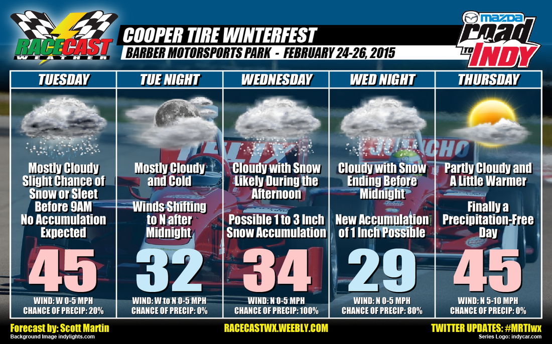
Tuesday:
I'm sticking to what I said in the last update from this morning. One of the latest model runs may have some snow flurries or light snow showers falling before 9AM instead of freezing rain. After that, just expect mostly cloudy skies with highs topping out in the mid 40s (above freezing by 10AM). Chance of snow or sleet before 9AM is 20%. Winds from the W at 0-5 MPH.
Wednesday:
The latest model runs are still showing a significant snow event for the Birmingham area. As of now, the potential is there for 1 to 3 inches, with some isolated amounts up to 8 inches where a deformation zone develops in the system. Time of arrival should be sometime between 7AM to 11AM. It is still early for this forecast, as I said earlier, snow events in the Deep South are very challenging for the most experienced meteorologists. Right now the high should top out in the mid 30s, but I believe once the snow starts falling, temperatures will fall to the lower 30s to even the upper 20s by 5pm. More snow is expected during the evening. Another inch of accumulation is expected before the snow ends around midnight.
Thursday:
Partly cloudy skies and a break from the all the sleet and snow. Highs will top out in the mid 40s with winds from the N at 5-10 MPH.
Once again, it only takes a shift of a few miles to make this an all rain even or a larger snow event. I'll update the blog and send out more info on my Twitter feed and our Facebook page.


