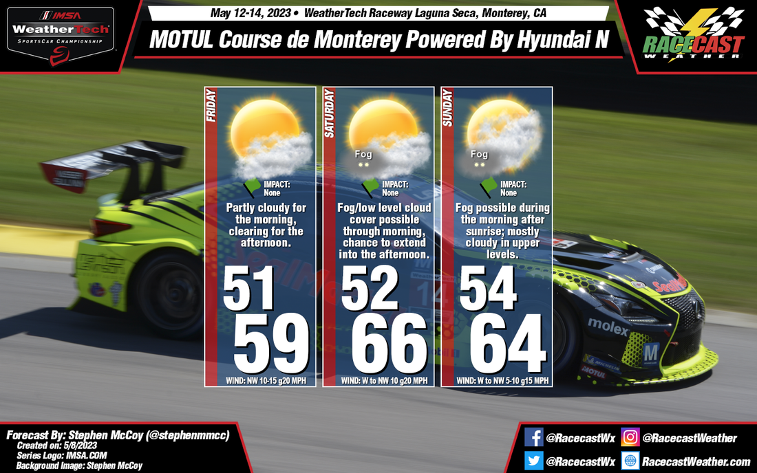
On the synoptic scale, a low pressure surface trough is expected to extend along the California coastline, and remain mostly stationary through the weekend. The alignment of the trough will result in surface winds mainly from the northwest throughout much the forecast period; normally we would see a land-sea interaction where winds would flip between the day and night. The moist air off the Pacific Ocean will enter the Monterey Bay area, condensing as it encounters the trough, which will result in partly cloudy conditions in the low-to-mid levels. As the temperatures get cooler in the mornings, this may also lead to some localized areas of fog which have a chance to last into the late morning.
Temperatures will be near normal for this time of year, though the strength and direction of the surface winds may swing the highs by a few degrees, especially for Saturday and Sunday. For Sunday, cloud cover may be largely in the upper levels due to a cutoff upper level trough located near to the region. We'll see cloudier conditions the further west the trough is, however if the low ends up more to the east, clearer conditions will be more likely.


