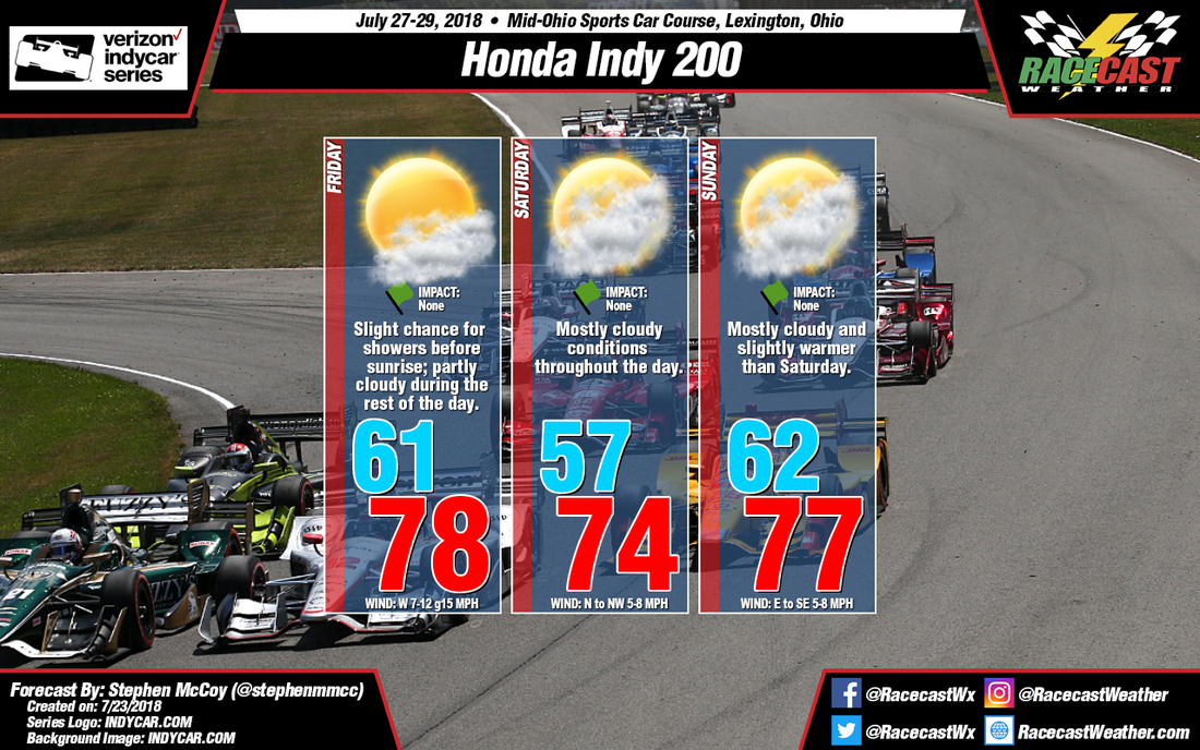
A cold front associated with a low pressure system over eastern Canada will move eastward through the Midwest Thursday night into early Friday morning, bringing a slight chance of scattered showers into the area. Westerly wind behind the front at the surface and northwesterly winds in the low to mid levels of the atmosphere will bring cooler air into the region relative to average temperatures for this time of year. Partly cloudy conditions are likely during the day on Friday, with most cloud cover located in the lower levels.
Behind the cold front, an area of high pressure will build into the Midwest late Friday and into Saturday. With the center of the system to the west of the track, winds will be primarily from the north and northwest during the day on Saturday, bringing cool air into the region from southern Canada. Moist air in the lower and upper levels of the atmosphere means some heavier cloud cover will persist for much of the day, but with the high pressure system, any chance of precipitation is unlikely.
I'm not very confident about Sunday's forecast and I expect it to change during the week. At the moment, the GFS and ECMWF models disagree about the conditions on Sunday, as the GFS indicates a chance for scattered showers while the ECMWF keeps conditions dry. The GFS shows a warm front extending from a low pressure system in the southern plains, with winds from the south bringing warm, moist air to the region. The ECMWF doesn't include the same system in its latest run and shows easterly winds for Sunday. Again, I expect things to change once more model data is available so look later in the week for a more definitive forecast.


