
By: Stephen McCoy
Lots of sunshine and warm temperatures for the Pirelli World Challenge series as they head to Utah Motorsports Campus for the Grand Prix of Utah.
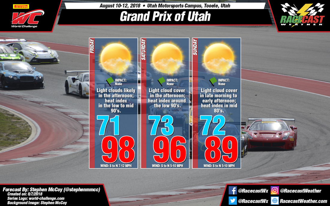
An upper level high pressure ridge will be present over the western US throughout the forecast period, diverting air in the upper levels to the north into Canada. Because of this, air over the Salt Lake region will stagnate, setting up dry conditions in the upper levels. On Friday, the high pressure ridge will be at its strongest, effectively trapping air underneath it and warming temperatures to the upper 90's. However, with dry air at the surface, heat index values will remain in the low to mid 90's. With the Great Salt Lake close by to the track, a sea breeze will be expected throughout the weekend with winds coming from the south during the morning, then shifting to the north through the afternoon and evening. Winds in the low to mid levels will be mostly from the south which could bring some moisture, and as a result, light cloud cover to the region.
Saturday will look much like Friday, though with a slightly weaker high pressure in the upper levels temperatures will be in the mid to upper 90's, with heat index values around 90. On Sunday, the upper level high pressure ridge will begin to stretch eastward towards the Midwest, continuing to weaken over the Salt Lake region, resulting in slightly cooler temperatures in the upper 80's with heat index values in the low to mid 80's. Much like with the rest of the weekend, some light cloud cover is expected in the late morning to mid afternoon.


