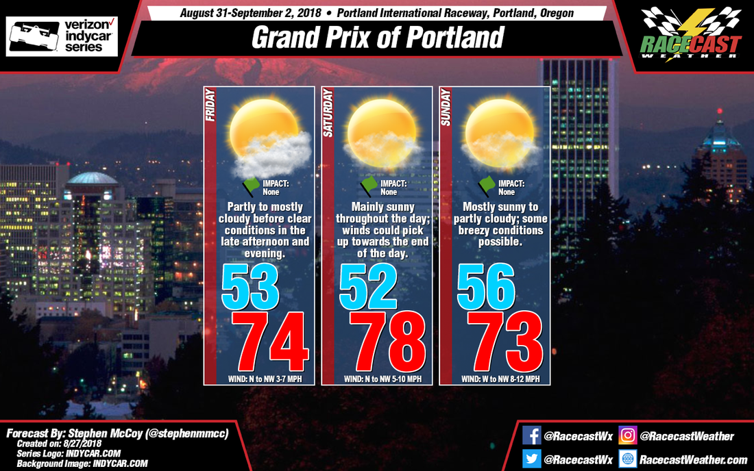
On Friday, upper level winds are expected out of the northwest as the back side of a longwave trough will be over the region; this will bring dry air and, as a result, clear conditions aloft. In the lower levels and at the surface, a high pressure system over the Pacific Ocean will direct winds from the northwest to northwestern Oregon. The air at the surface will remain dry, however moist air at the lower levels will cause some partly to mostly cloudy conditions around mid-day. With northerly to northwesterly winds at the surface, temperatures will likely reach the low to mid 70's.
Conditions look similar for Saturday, except for upper level winds shifting to the west and southwest as the longwave trough continues eastward. Dry air will also move into the lower levels, causing mostly clear conditions for much of the day.
Sunday shows a divergence in the models, with the GFS indicating temperatures in the mid 60's with a slight chance for showers throughout the afternoon and light, variable winds. Meanwhile, the ECMWF shows similar conditions to the rest of the weekend, with the addition of some stronger winds from the west to northwest. At this point it's difficult to forecast definitively one way or the other, but I am leaning more towards conditions remaining dry with temperatures remaining similar to the rest of the weekend. Should conditions change, they will be mentioned in the next update.


