
By Doug Schneider
A wet weather pattern sets up in the Midwest later this week, and the GMR Grand Prix will likely be impacted.
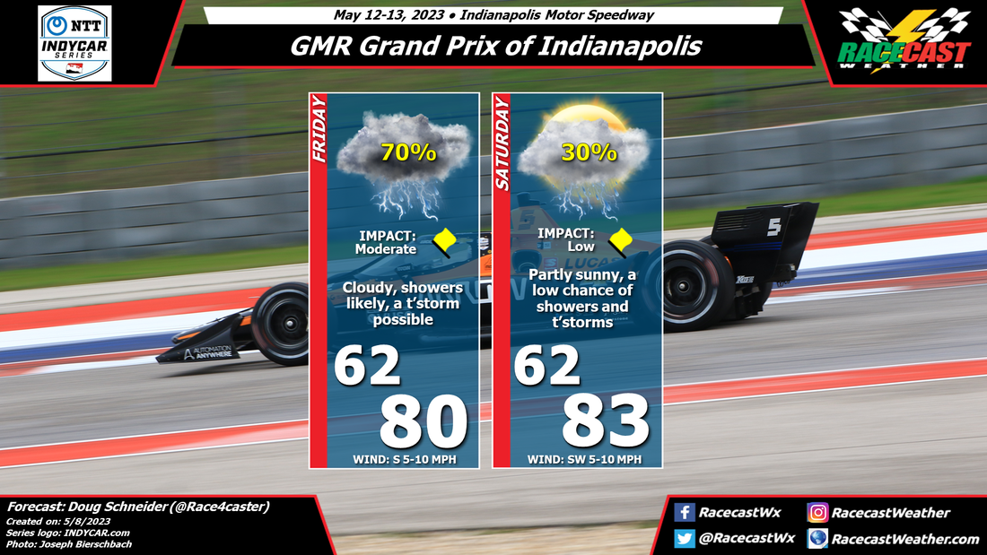
A warm front will be lifting northeast across Indiana early Friday morning. This will bring a warm and moist air mass to the area. During the day, a disturbance in the middle and upper levels of the atmosphere will cross Indiana, which will bring numerous showers and a few thunderstorms. This may result in some of the sessions being delayed at times, depending on the exact timing of thunderstorms (which is uncertain this far out). If you plan to be at the Speedway on Friday, bring your wet weather gear. As we get closer to Friday, I'll have a better idea of how much rain might fall, and hopefully I can pin down the timing a little more precisely.
The upper level disturbance will exit the area Friday night, taking most of the rain out of the area. Through Saturday, the atmosphere will still be warm and humid, so there could be enough instability to spark a few afternoon showers and thunderstorms. But the coverage of these showers are expected to be isolated to scattered, so the chance of one hitting the Speedway is low, about 30%.
Check back later in the week for forecast updates.


