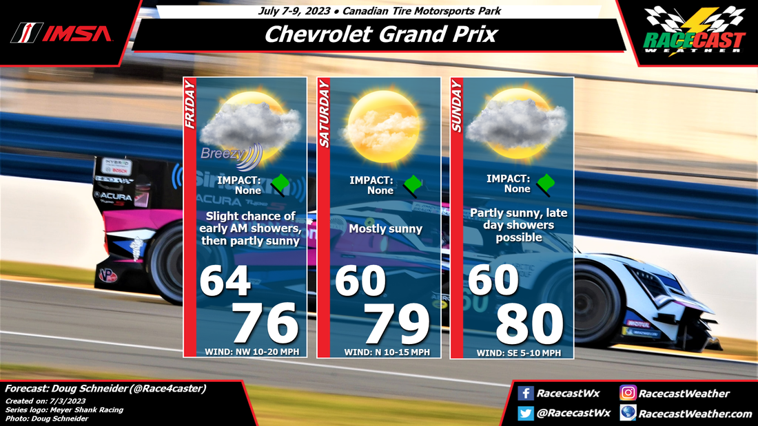
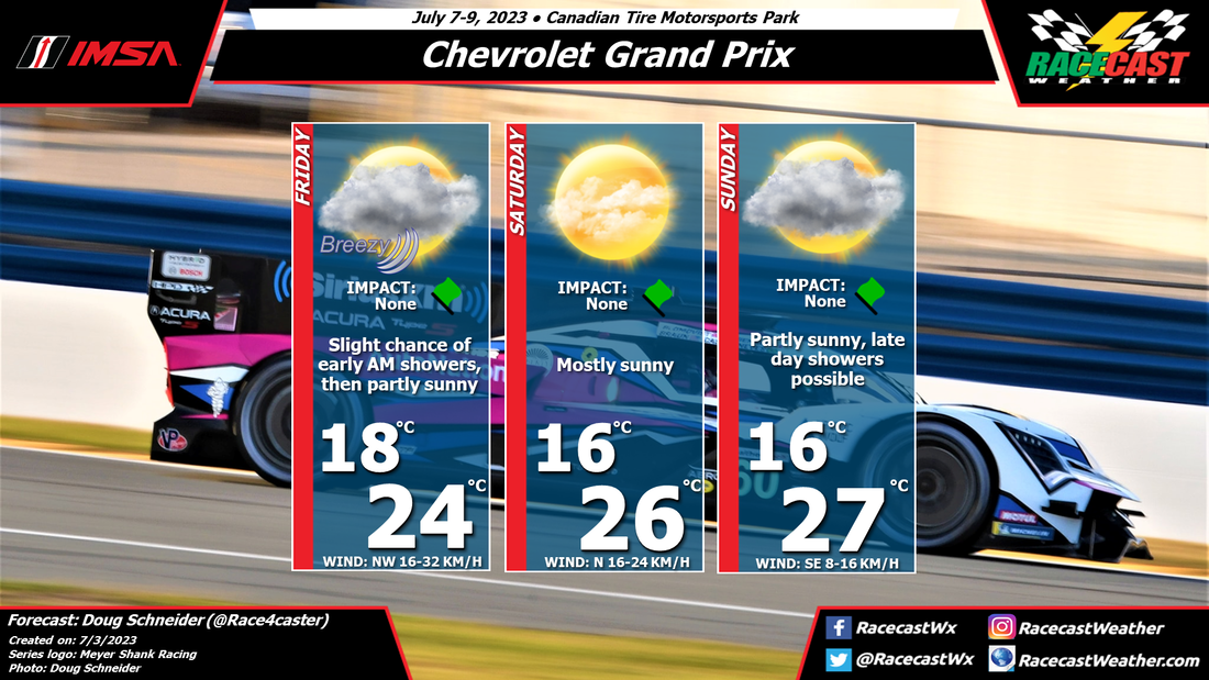
A cold front is expected to cross the area sometime between late Thursday through Friday morning. Model difference in the timing makes it uncertain, but I think the most likely timing will take showers out of the CTMP area before on-track activities begin Friday morning. It will be breezy through the day as wind shift to the northwest, and sustained winds will be between 10 and 20 mph with gusts up to 30 mph possible.
Saturday should be a very nice day, with mostly sunny skies and mild temperatures, thanks to high pressure building in that will supply dry air.
Sunday is still uncertain, but I'm keeping it dry for now. Most models do the same with rain moving in on Monday, but a couple show showers spreading into the area through the day on Sunday. I will take the optimistic route on this one and keep Sunday dry, with the caveat that it could change with updated forecasts later in the week.


