
By: Stephen McCoy
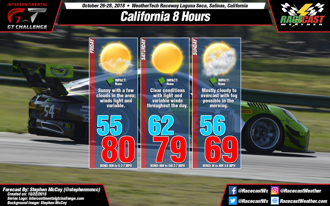
Dry air will set up a nice weekend for the California 8 Hours this weekend, with temperatures hovering around 80 and clear conditions expected on Friday and Saturday. Slightly cooler temperatures and mostly cloudy to overcast skies will move in on Sunday.
On Friday, an upper level ridge will move into the region from the west along with a ridge in the mid-levels of the atmosphere. The lack of flow from these ridges accompanied by dry air will result in clear to mostly sunny conditions for the day. The clear conditions will allow plenty of daytime heating to occur at the surface, with the high temperature for Friday approaching 80 degrees. Winds from the northwest during the day are expected to keep dew point temperatures in the upper 40's; winds will likely shift to the south to southeast and weaken slightly during the evening and night as downslope flow occurs off the Santa Lucia Range. Similar conditions are expected for Saturday, with clear conditions more likely as the center of the ridges pass over central California.
On Sunday, the ridges are expected to continue tracking eastward, with the backsides moving over the region, and causing upper level and mid level winds to shift towards the southwest. Moisture will move into the mid and upper levels, resulting in mostly cloudy to overcast conditions for the day. Some morning fog is possible in the morning should the low temperature get cool enough to condense near the surface. Cooler temperatures are expected as winds will slightly increase as a stronger pressure gradient sets up just off the coast to the west.


