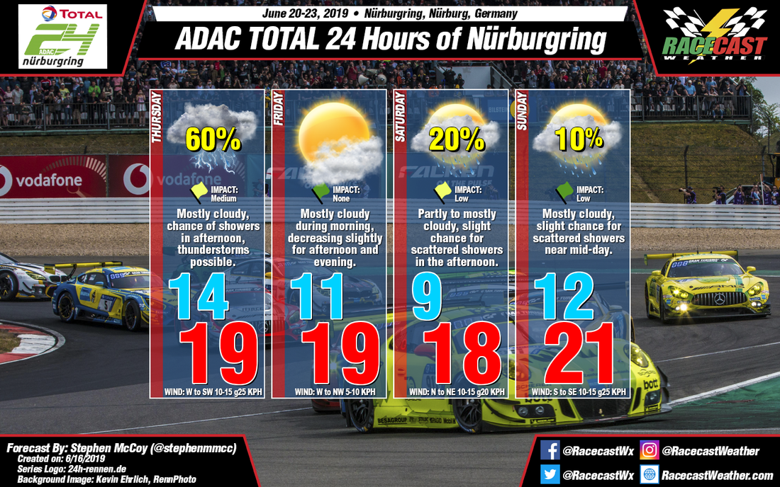
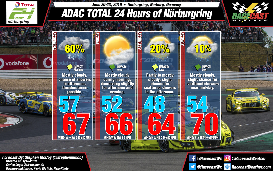
At the time of this forecast, a surface low pressure system is located to the east of the British Isles over the North Atlantic, sitting directly underneath of an upper level trough. Minimal movement is anticipated from the trough through Tuesday, and as a result the surface low will continue to remain stationary. A shortwave upper level trough is expected to move eastward into the Iberian Peninsula on Tuesday, resulting in a low pressure system forming off the western coast of France. With the former surface low to the east of the British Isles, an interaction known as the Fujiwara effect will occur, directing the latter system to the northeast towards Scandinavia. A cold front extending south from the second low will move through the western Germany on Wednesday, bringing a chance for thunderstorms to the region in the late afternoon to evening. On Thursday, the combination of the first low pressure system (now north of Scotland) and a surface high pressure system over Spain will result in winds from the west to southwest. In addition to the surface, winds in the low to upper levels are anticipated from the southwest, bringing moisture to the region throughout much of the atmosphere. The increase in moisture will result in a likely chance for precipitation, especially in the afternoon, with thunderstorms possible.
The aforementioned high pressure system will track north/northeast through the weekend, reaching northern France by Friday. The anticyclonic rotation around the high will result in surface winds at the track from the west to northwest through the day. A region of dry air in the mid levels is expected to build in which will suppress convective potential. Some moisture in the lower levels will cause some mostly cloudy conditions during the morning with partly cloudy conditions anticipated for the afternoon and evening.
On Saturday, the high pressure system will be over Great Britain, with winds over Germany now from the north to northeast, which will cause slightly cooler temperatures during the day. Moisture in the low to mid levels from southerly winds will likely result in partly to mostly cloudy conditions through the day and into overnight; a slight chance for scattered showers is possible in the afternoon as a result of the amount of moisture. Mostly cloudy conditions are expected to stick around for Sunday with another (albeit lower) chance for scattered showers near mid-day. A surface low pressure system will once again form west of the British Isles ahead of an upper level trough. The system will have an influence on the winds at the track, causing them to shift to the south to southeast during the day which will warm air temperatures to the maximum of the weekend.


