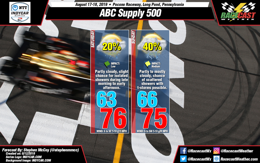
On Saturday, a surface high pressure system sitting off the east coast of the US will cause winds from the south to southeast through most of the day; morning winds will be largely variable. Fog may be possible near sunrise as the surface air is expected to be saturated under a temperature inversion. A slight chance for isolated showers exists during the morning to early afternoon as moisture from the Atlantic saturates the air in the low levels of the atmosphere. Precipitation chances will increase if the air at the surface remains saturated through the morning; should showers occur, they will likely be non-thunderstorms. Partly cloudy conditions will be present in the low levels for the remainder of the day.
For Sunday, an upper level trough will be moving eastward through southern Canada and the Midwest US with an accompanying surface low pressure system over the Hudson Bay/Quebec region. A cold front will be extending southward from the center of the system, moving through the northeast US during Sunday afternoon. A few isolated showers may be seen in the area ahead of the front, but the bulk of the rain is expected to move through the region towards the conclusion or after the main race. The current run of the GFS shows mixed-layer CAPE values above 1000 J/kg, suggesting thunderstorms will be present along the front. The high temperature in the afternoon could vary depending on the timing of the frontal passage, though looking at model output, only by a few degrees. South to southwesterly winds at the surface and in the low levels will cause some stronger winds gusts through the day.


