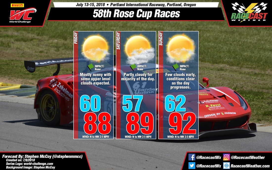
For Friday, temperatures will approach the upper 80's with little cloud cover as a temperature inversion sets up over the region in the low to mid levels in the atmosphere. Conditions should feel slightly more bearable as light winds from the north to northwest and dew point temperatures in the upper 40's are expected. In the upper levels, moist air from the North Pacific Ocean will move in from the west to southwest, resulting in some high level cirrus clouds over the region; besides the upper levels, chances for cloud cover are nearly non-existent.
For Saturday, temperatures are expected to remain constant with Friday, with highs in the upper 80's, but again with dew point temperatures in the upper 40's and light winds from the north to northwest. Cloud cover is expected to continue in the upper levels, however in the upper to mid levels, winds will shift to the southwest, bringing more moisture into the region. Because of this, chances for partly cloudy conditions are more likely for Saturday.
For Sunday, the models have been in disagreement for the high temperature, with more recent models of the GFS suggesting a high in the upper 90's to over 100, while other models including the ECMWF and German global model indicate temperatures in the upper 80's to low 90's. For the moment, I've decided to split the difference, forecasting a high temperature in the low 90's; look for updates later in the week for a more confident forecast.


