A strong upper level shortwave trough will move through the region towards the southeast US through the beginning of the week into Thursday. A surface low pressure system is expected to develop over the Gulf Coast ahead of the trough, moving northeast up the Atlantic coast late Thursday; an area of high pressure will build at the surface as the low move out of the region. Behind the upper level trough, conditions will return to zonal flow, with winds coming from due west through the end of the week.
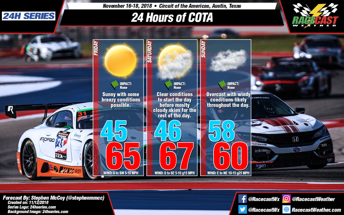
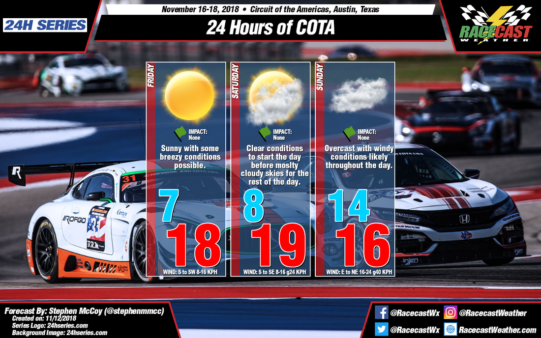
Sunny conditions are expected on Friday with dry air moving in to the region at all levels of the atmosphere. Initial surface winds from the southwest will contribute to a low temperature in the mid 40's F, however as the day progresses, winds will shift towards the south as the surface high pressure system slowly tracks eastward across Louisiana and Mississippi. The winds will bring warmer air from the Gulf to central Texas, resulting in high temperatures in the mid 60's F.
Similar conditions are expected on Saturday, with the exception of clear skies, as the zonal flow in the upper levels will bring moisture originating over the Pacific into the area. Conditions will likely start clear in the morning, but cloud cover will increase through the day as the upper level moisture moves over around mid-day. Surface winds will shift slightly during the day to the southeast, causing temperatures to be slightly warmer in the upper 60's F.
Going back to Wednesday, a surface low pressure system will develop over Canada (known as an "Alberta Clipper") and track eastwards through the week. After approaching the Great Lakes region on Saturday, a cold front will extend from the system well to the southwest, reaching into Oklahoma and northern Texas. As the low continues its track, the cold front will track southward, approaching central Texas by Sunday morning. There is currently a split in the models as to when the front will reach the region, with the ECMWF indicating a passage in the early morning before sunrise and the GFS indicating a passage closer to mid-day.
This graphic follows the synoptic pattern provided by the GFS where southeasterly winds from Saturday continue to bring warmer temperatures into Sunday morning before the frontal passage. The result would be a low temperature about 10 degrees warmer than Friday and Saturday. The high temperature would only be a few degrees warmer than the low as the front would only allow daytime heating to occur for a couple of hours before it passes and drops temperatures into the lower 50's F. If the Euro is correct, temperatures will be cooler than on this graphic with the high temperature occurring just after sunrise before dropping to the lower 50's F for the remainder of the day. Regardless of timing of the frontal passage, winds will shift to the north, with wind speeds around 10-15 mph and gusts approaching 25 mph. The front will also bring overcast conditions to the region for most of the day.


