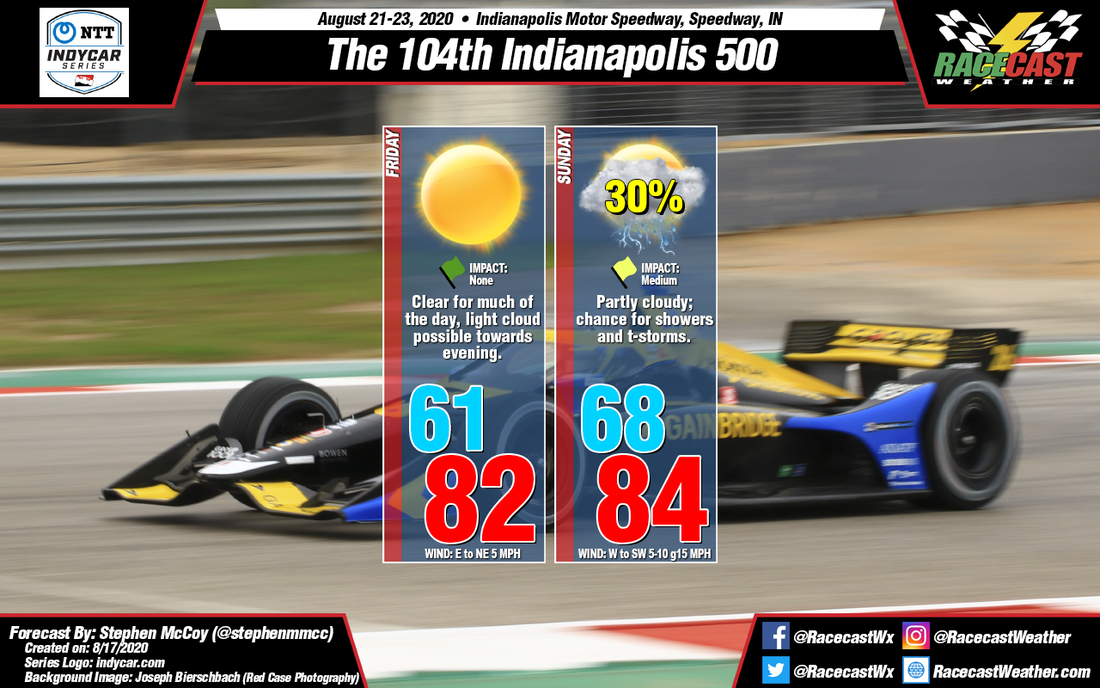
For Friday, an upper level trough will center itself to the east of central Indiana, resulting in upper level winds mostly from the north/northwest through the day. Drier air from Canada will move over the region, causing clear skies for much of the day. At the surface, an area of high pressure will be present over the area, keeping surface winds relatively light from the east to northeast, though at times wind direction will be variable.
For Sunday, an upper level shortwave trough will move through the northern plains on Saturday, allowing a surface low pressure system to form just to the east. The surface low is anticipated to move eastward through southern Quebec with a cold front trailing behind it to the southwest. Sunday morning, the front is expected to approach central Indiana, bringing with it a chance for showers and thunderstorms, along with slightly warmer daytime temperatures and stronger winds. Surface winds will be largely from the southwest ahead of the front, but will shift to the west if the front passes over the region. Partly cloudy skies are expected as a result of the oncoming front along with mid-level moisture moving into the region from the northwest.


