
By: Stephen McCoy
Much more pleasant conditions for the GT World Challenge America season opener than last year, with near-average temperatures and mixed amounts of cloud cover through the weekend.
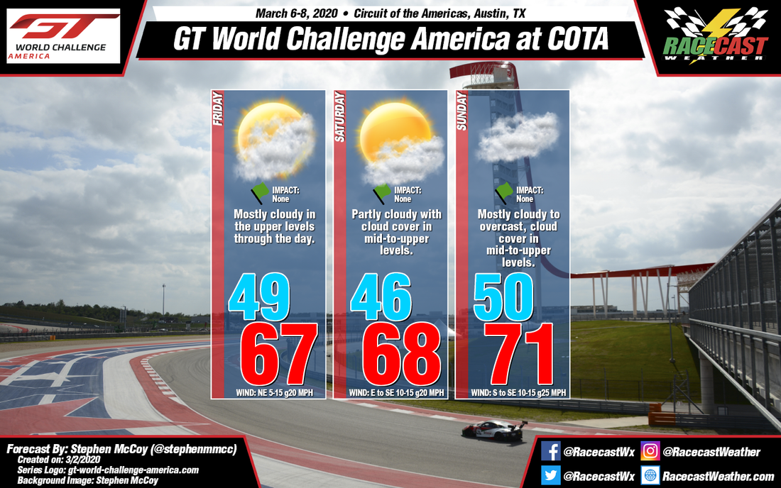
Conditions for this weekend begin earlier this week as an upper level low pressure trough moves eastward over Northern Mexico and the US Southwest. A surface low pressure system will be present ahead of the trough with a cold/stationary front extending further East. The front is expected to bring rain with thunderstorms to the region on Tuesday into Wednesday morning. As the trough and low pressure move into the Southeast US, high pressure will begin to build in ahead of an upper level high pressure ridge, which will remain over the South-central US into next week.
On Friday, the surface high will be centered to the North/Northeast, causing winds mostly from the Northeast through the day and temperatures near the daily average, though a bit cooler than earlier in the week. Cloud cover will begin increasing in the upper levels overnight Thursday into Friday as Southwesterly winds bring moisture in from the Pacific Ocean. For the remainder of the weekend, the surface high will continue moving eastward, resulting in winds slowly shifting to the East to Southeast on Saturday, then to the South to Southeast on Sunday. Some of the cloud cover will break up for Saturday as drier air moves in, however mostly cloudy to overcast conditions will be present on Sunday as mid level winds bring increased moisture to the region from the Gulf of Mexico while the upper level winds resume in carrying moisture from the Pacific.


