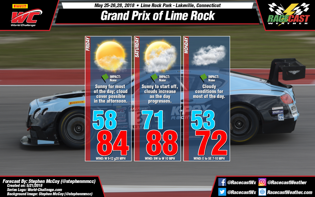
Starting with the upper atmospheric setup for Friday, the upper level jet stream is expected to set up over the Northeast US/Southeast Canada, bringing cool, dry air into the region. The low level jet stream will be bringing air into the region from the northwest as well in the morning hours before turning towards the west. The direction of the two jet streams in the morning will keep temperatures cool to start and will bring clear skies for most of the day. Little cloud cover, with the addition of westerly winds at the surface and lower levels, will allow for plenty of daytime heating and cause temperatures to reach into the low-to-mid 80’s. With both the surface and low level winds coming from the west, expect some breezy conditions with some gusts approaching 20mph.
A strong low pressure system over southeastern Canada is expected to track eastward Friday into Saturday. According to the latest runs of the GFS model, a cold front will set up north of New England and slowly move southward during the day on Saturday. With this setup, temperatures will likely remain warm overnight as winds will be from the south and southwest. Expect heavier cloud cover than Friday as moisture moves into the area in the lower levels of the atmosphere. A threat of rain is possible with the cold front; however frontal passage should occur after track activities have ended.
On Sunday, a high pressure system will develop over Canada before tracking southward over New England and into the Atlantic Ocean on Monday. Cool winds from the east off the Atlantic will keep temperatures cooler, with a low in the low-to-mid 50’s and a high around 70. Moisture off the Atlantic will likely result in some cloudy conditions for Monday.


