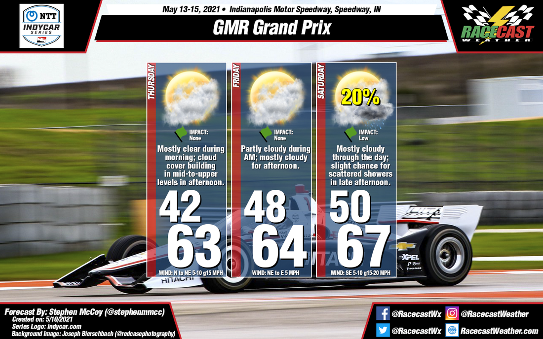
For much of the weekend, we'll see high pressure present at the surface, building in from the west. The position of the center of the high to the west/northwest of central Indiana will cause winds from the north/northeast through Thursday and Friday, shifting to the southeast on Saturday as the high continues eastward. In the upper levels, a split flow blocking pattern will emerge beginning Thursday morning, leading to mostly clear skies. A slight shift in the winds to the west/southwest will cause some cloud cover during Thursday afternoon; similar conditions will be present for Friday.
An upper level trough will allow a surface low pressure system to develop over the plains Friday into Saturday, with its warm front approaching the Midwest Saturday afternoon. Depending on the timing, the front could result in scattered showers in the area, especially in the late afternoon to evening. Upper level winds continuing from the west will cause mostly cloudy to overcast conditions through Saturday as they transport moisture lifted by the low over the region.


