
By: Stephen McCoy
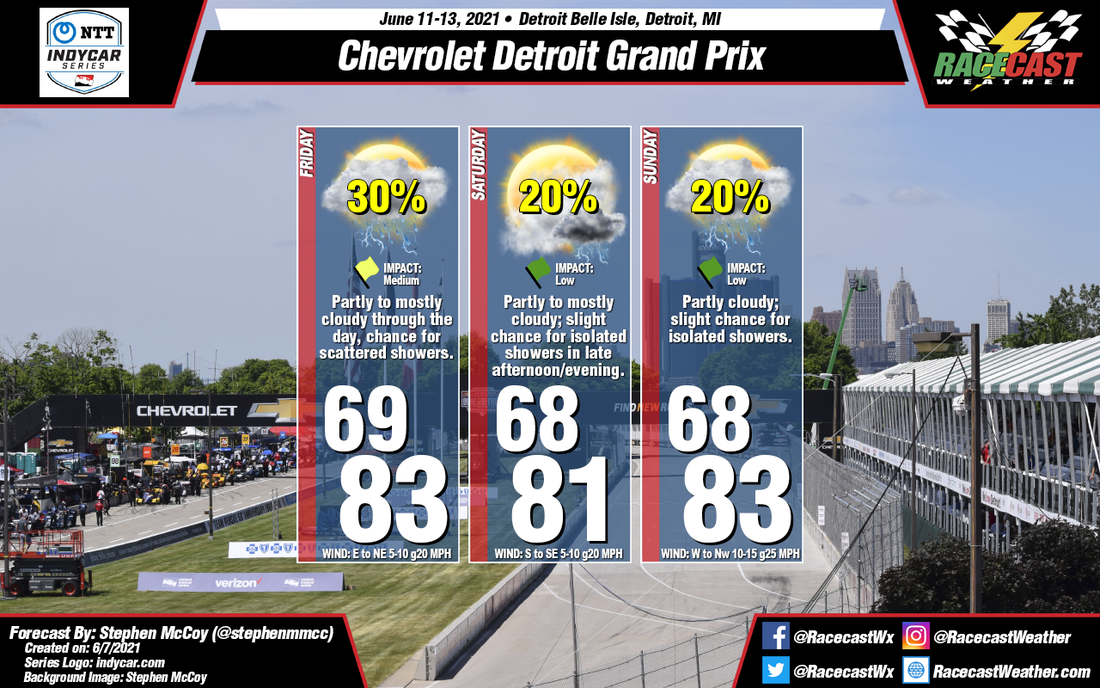
Near-summertime conditions will be present for this weekend's races at Belle Isle. We'll see consistent temperatures all three days with lows in upper 60's and highs in the low-to-mid 80's; chances for isolated to scattered showers will also persist through the weekend.
Friday's conditions are expected to begin mostly cloudy, mainly in the upper levels, due to a low pressure system to the southeast. Meanwhile, an area of high pressure will be centered to the north, causing surface winds from the east/northeast. As a result, slightly cooler temperatures will move in, with the cooler air undercutting the already-present warm air. This may allow for the development of showers and/or thunderstorms in the region, especially as temperatures reach their highest in the afternoon. As the aforementioned low moves eastward, cloud cover will begin diminishing.
An approaching cold front from the west will pass through the region Saturday in the evening to overnight. Beforehand, winds will be largely from the south/southeast with temperatures mostly consistent with those on Friday. The front will bring with it a slight chance for isolated to scattered showers and/or thunderstorms in the late afternoon to evening. For Sunday, temperatures are expected to continue from earlier in the weekend with winds from the west to northwest; some stronger gusts may be possible, especially in the afternoon. With the front having passed over, conditions will be partly cloudy to mostly clear through much of the day.


