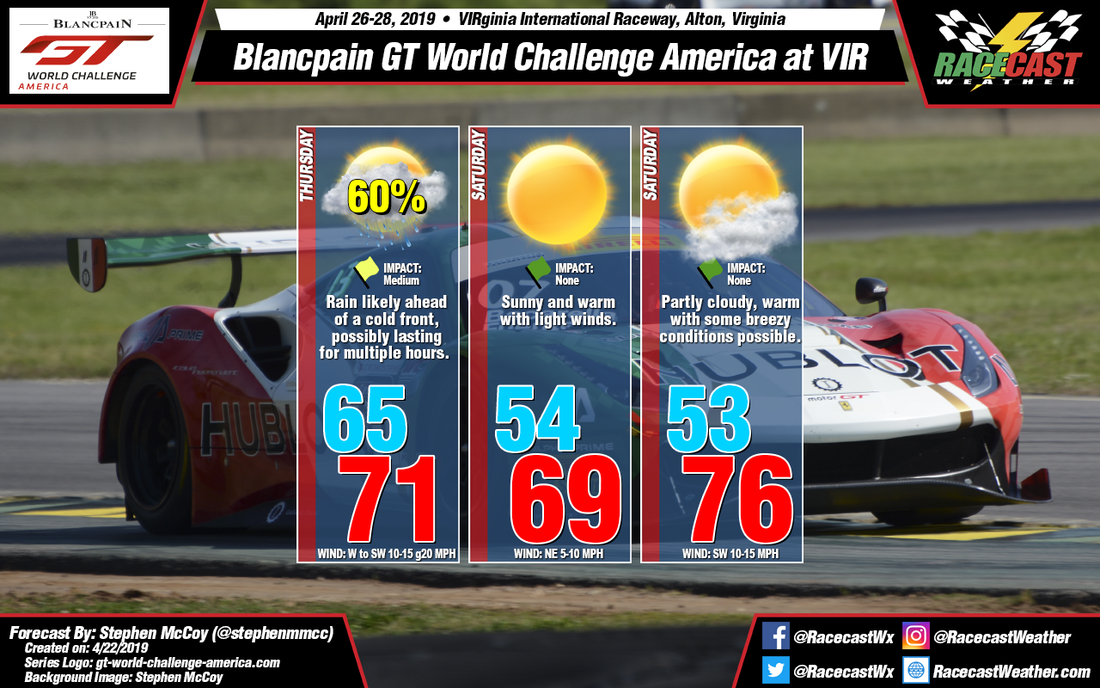
Behind the surface low, an area of high pressure will build in over the Midwest, bringing calmer winds from the northeast. Dry air will move in through the atmosphere behind the front, with clear conditions expected for much of Saturday. Late Friday into Saturday, another surface low pressure system will form off the eastern side of the Rockies and will track eastward across the U.S towards New England. A cold front will approach southern Virginia from the north on Sunday, however at the moment no precipitation is expected to reach the track. Southwesterly surface winds will warm temperatures to the mid-70's while west/southwesterly winds in the mid-to-upper levels result in partly cloudy conditions through the day.
|
By: Stephen McCoy Wednesday evening, an upper level shortwave trough is expected to develop over northern Montana, along the U.S./Canadian border, and will deepen as it propagates eastward through Friday. A surface low pressure system will form over the Midwest ahead of the trough, tracking to the northeast in the same time frame. Precipitation ahead of a cold front extending to the southwest from the surface low will likely affect on track activities to some extent on Friday. Surface winds ahead of the front are expected out of the southwest at 10-15 mph; low level winds from the same direction will cause some stronger gusts upwards of 20 mph. After the front passes, winds will shift to the northwest as temperatures cool to the mid 50's for Saturday morning.
Behind the surface low, an area of high pressure will build in over the Midwest, bringing calmer winds from the northeast. Dry air will move in through the atmosphere behind the front, with clear conditions expected for much of Saturday. Late Friday into Saturday, another surface low pressure system will form off the eastern side of the Rockies and will track eastward across the U.S towards New England. A cold front will approach southern Virginia from the north on Sunday, however at the moment no precipitation is expected to reach the track. Southwesterly surface winds will warm temperatures to the mid-70's while west/southwesterly winds in the mid-to-upper levels result in partly cloudy conditions through the day. |
Social Feeds
Authors
Doug Schneider Partners
Categories
All
Archives
December 2023
|


