The area of high pressure is expected to build in over central Ohio on Sunday, causing variable shifts in the wind direction at the surface. Low level winds will continue to bring moisture and cloud cover into the region; however at the upper levels, winds will shift to the southwest. This will also bring moisture into central Ohio and increase cloud cover for the day.
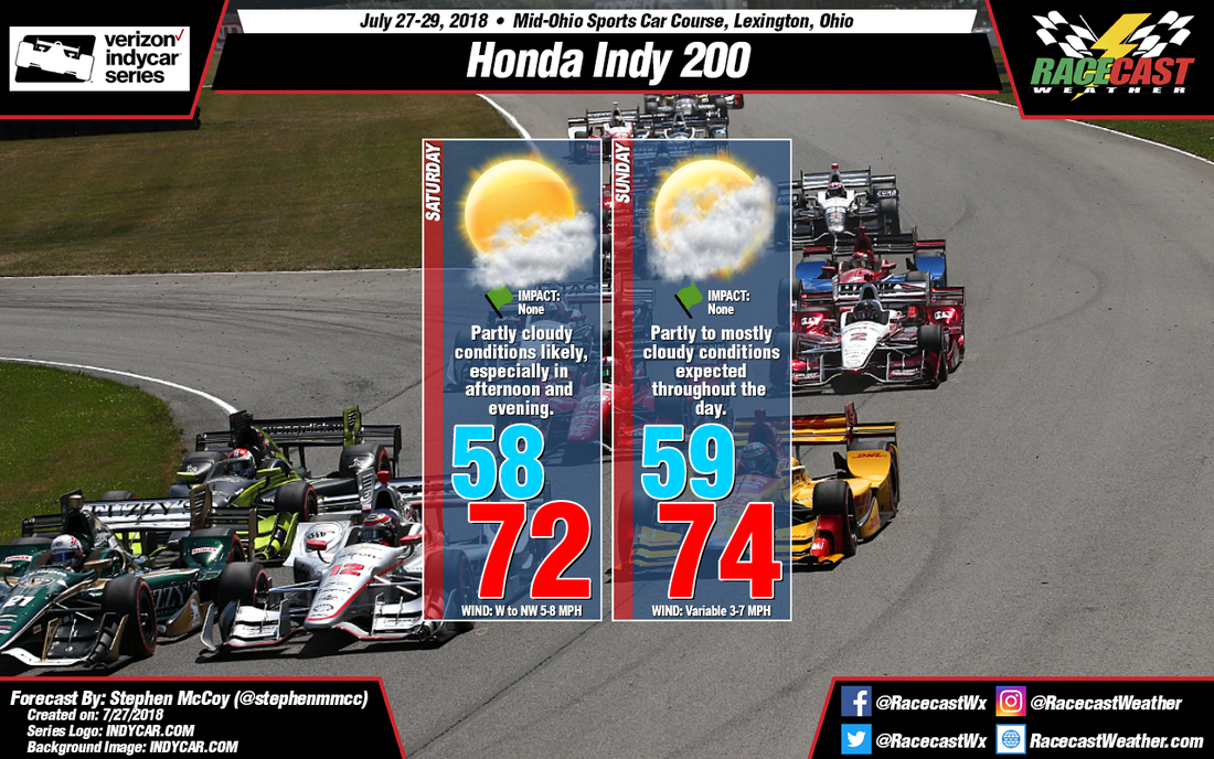
By: Stephen McCoy As a longwave upper level trough track eastward over the northeast and Mid-Atlantic states, upper level winds over the Midwest will continue from the west to northwest on Saturday, bringing dry air into the region and keeping upper level conditions clear. Moist air in the low levels of the atmosphere will likely result in partly cloudy conditions for much of the day, with cloud cover increasing as the day progresses. High pressure at the surface will continue to slowly move into the region, keeping temperatures below normal through light winds from the west and northwest.
The area of high pressure is expected to build in over central Ohio on Sunday, causing variable shifts in the wind direction at the surface. Low level winds will continue to bring moisture and cloud cover into the region; however at the upper levels, winds will shift to the southwest. This will also bring moisture into central Ohio and increase cloud cover for the day. |
Social Feeds
Instagram
Partners
Authors
Doug Schneider, Scott Martin, and Stephen McCoy are race fans and meteorologists dedicated to providing accurate forecasts and timely weather updates at racing venues around the world. We forecast for IndyCar, Indy Lights, Pro Mazda, USF2000, IMSA, Blancpain World Challenge America, and World Endurance Championship, as well as major SCCA and NASA events. Categories
All
Archives
December 2020
|