
By: Stephen McCoy
The models continue a downward trend in the temperatures for the rest of the weekend at the California 8 Hours. In the previous forecast, the surface winds were expected to decrease close to the land with the stronger winds moving further off shore. However in the most recent model runs, winds look to persist off the coast with maximum wind speeds reaching 20-30 mph. As these winds are from the north to northwest, cool air from the Pacific Northwest will continue to move into the region.
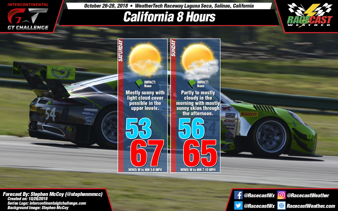
The centers of the mid level and upper level ridges previously mentioned are expected to cross into southern Arizona during the late morning on Saturday. Southwesterly winds in the upper levels will bring moisture to the region, however the models (especially the short range models) indicate most of the moisture will be located further to the north, around the Bay area. The result will be mostly sunny skies with some light cloud cover possible through the day.
As the upper level ridge continues eastward on Sunday, the band of moisture (extending to the southwest) will also move eastward, passing over the track throughout the morning. As a result, some heavier cloud cover is expected to start the race, but conditions are likely to clear in the late morning to mid-afternoon. Stronger surface winds off the coast will cause winds to pick up slightly during the day with temperatures remaining in the mid to upper 60's.


