
By: Stephen McCoy
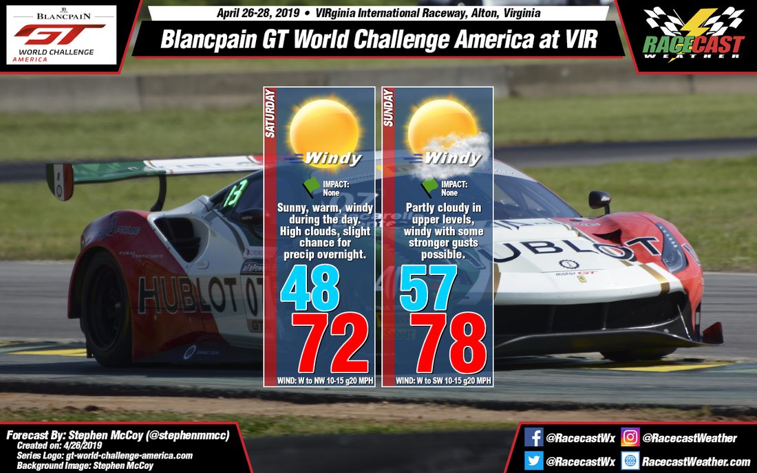
No major changes to the forecast for Blancpain GT World Challenge at VIRginia International Raceway. Temperatures will dip into the upper 40's tonight and tomorrow morning as northwesterly winds bring cooler air to the region. With plenty of sunshine on Saturday, temperatures are expected to rebound nicely with an afternoon high in the lower 70's. Some winds with stronger gusts are possible during the day as both surface and low level winds will be out of the west to northwest.
There is a slight chance for scattered showers overnight and into Sunday ahead of a cold front approaching from the northwest, but otherwise no precipitation is expected. The cold front, in addition to a high pressure system off the east coast, will cause some stronger winds again through the day. Air temperatures will be warmer in the upper 70's due to southwesterly winds, but with relative humidity around 40% temperatures may feel a degree or two cooler. Mostly cloudy conditions will move in overnight, decreasing during the day; for the most part cloud cover will be in the mid-to-upper levels.
There is a slight chance for scattered showers overnight and into Sunday ahead of a cold front approaching from the northwest, but otherwise no precipitation is expected. The cold front, in addition to a high pressure system off the east coast, will cause some stronger winds again through the day. Air temperatures will be warmer in the upper 70's due to southwesterly winds, but with relative humidity around 40% temperatures may feel a degree or two cooler. Mostly cloudy conditions will move in overnight, decreasing during the day; for the most part cloud cover will be in the mid-to-upper levels.


