
By: Stephen McCoy
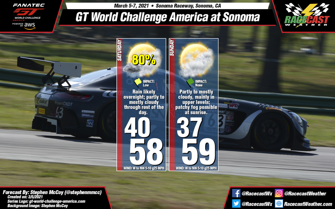
A cooler weekend awaits, especially in the mornings, after a relatively warm Friday. The cold front mentioned in the previous forecasts sis still expected to move through the region Friday night/early Saturday morning. The front will bring a likely chance for rain during the overnight hours, mostly around midnight, but chances will fall off Saturday morning before sunrise; no precipitation is anticipated for the remainder of the weekend. Little impact is expected to track sessions as a result, however early sessions might have to fit the rain tires.
Winds behind the front will be largely from the West/Northwest, bringing in cooler air from the northern Pacific, with temperatures during the mornings in the upper 30's to low 40's and afternoon temperatures in the upper 50's to low 60's. Moist air in the upper levels of the atmosphere from the Southwest will result in partly to mostly cloudy conditions for both Saturday and Sunday while some low level cloud cover is possible, especially in the mornings; patchy fog may be present Sunday morning.
Winds behind the front will be largely from the West/Northwest, bringing in cooler air from the northern Pacific, with temperatures during the mornings in the upper 30's to low 40's and afternoon temperatures in the upper 50's to low 60's. Moist air in the upper levels of the atmosphere from the Southwest will result in partly to mostly cloudy conditions for both Saturday and Sunday while some low level cloud cover is possible, especially in the mornings; patchy fog may be present Sunday morning.


