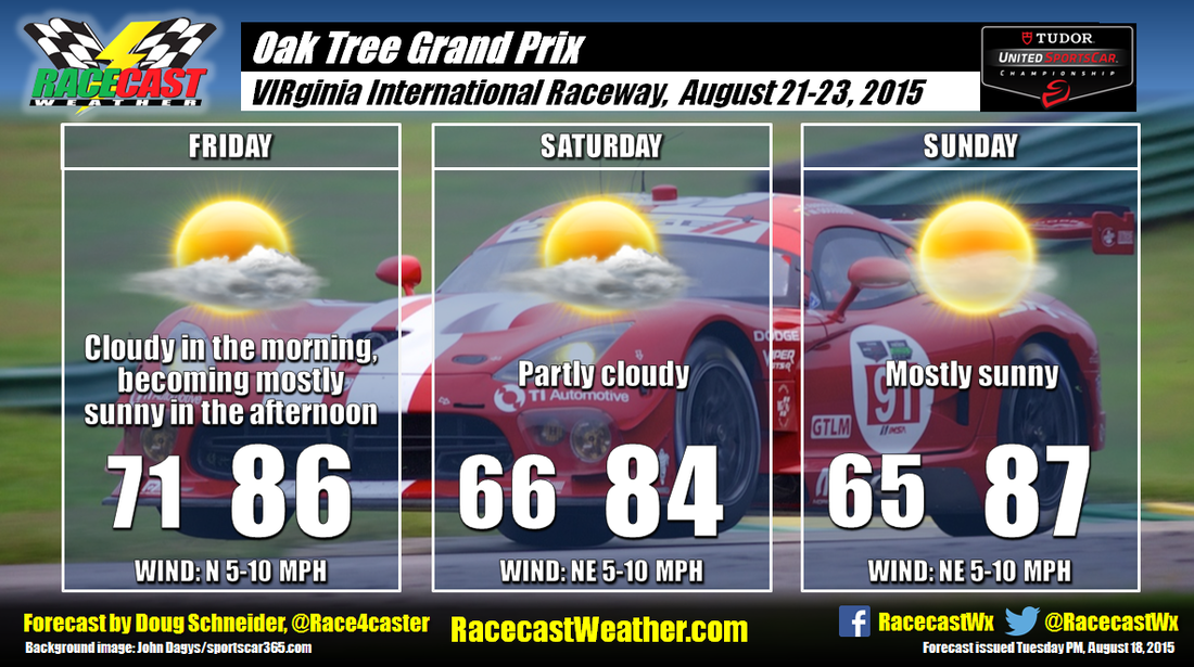
The models show the weather pattern evolving a little more quickly than when I did the forecast yesterday morning. A cold front will be approaching the Appalachians on Thursday, and there will be plenty of moisture ahead of the front for showers and thunderstorms on Thursday. By Friday, the front will have moved through and fizzle out, and high pressure begins to build into the area. Drier air aloft will move in from the northwest, and push the shower and thunderstorms activity toward the coast and across the Carolinas, away from VIR. So it looks like Friday will be a dry day, despite some morning clouds.
Saturday and Sunday will feature a surface high pressure ridge extending northeast to southwest along the Virginia foothills and Piedmont, with a mid to upper level ridge over Florida. This pattern looks favorable for dry conditions each day, with a good amount of sunshine. Temperatures and humidity won't be excessively high, with temperatures reaching into the mid to upper 80s and dewpoint temperatures in the 60s.


