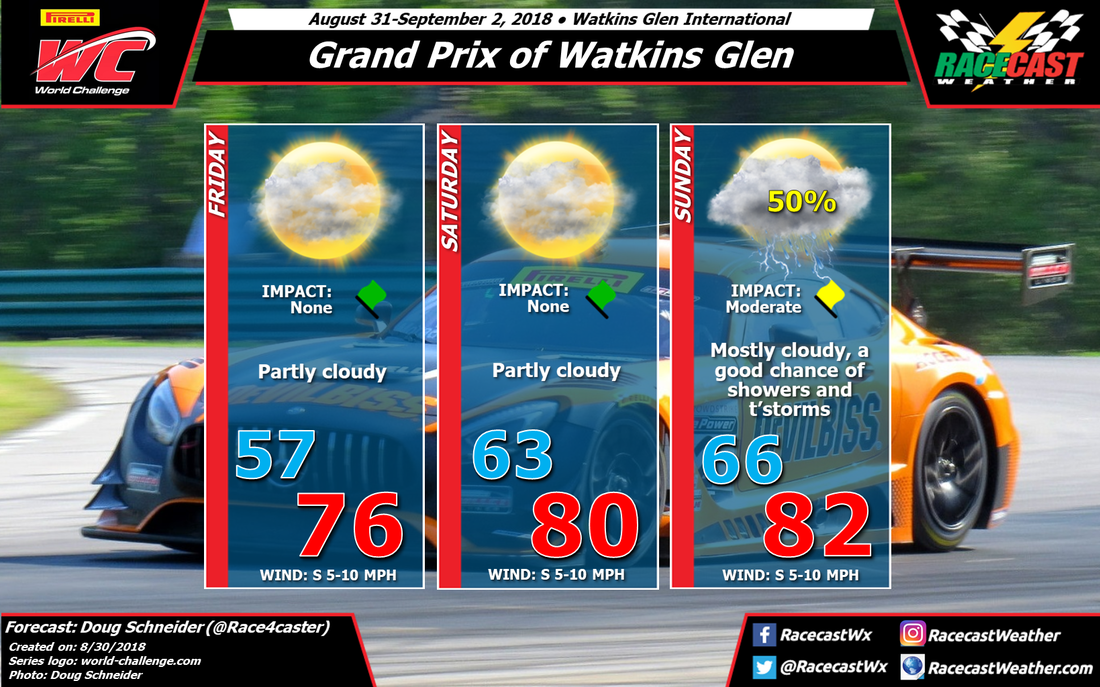
Not a whole lot has changed in the forecast for PWC weekend at Watkins Glen, as the models have been holding fairly steady over the past few days. However, there are still some disagreements among the models regarding the timing of rain on Saturday night and Sunday, as well as potential rain amounts.
High pressure will be located over Quebec on Friday morning, and extend southward across New York. The air mass associated with this high will be quite pleasant, with high temperatures in the mid 70s and comfortable humidity levels. Some models are showing afternoon showers developing across Pennsylvania and moving north into New York, but I strongly doubt that they will make it far enough north to pose any problems for the day's practice sessions.
The high pressure area continues to move east on Saturday, while a low pressure system starts to track into the upper Great Lakes region. This will bring a southerly flow that will increase the temperature a little, as well as the humidity. Despite the increase in moisture, I don't think that lift or instability will be enough to produce much shower activity in the area. I can't say the chance of rain is zero on Saturday, but I think it is low enough that I can remove it from the forecast with this update. Maybe a 5-10% chance.
Rain chances start to rise on Saturday night. The models show an upper level trough tracking into far western New York Saturday evening. This should provide enough lift to bring showers into Watkins Glen on Saturday night. It is possible that some showers could linger into Sunday morning, and the morning Radical race may have to deal with a wet track. After that moves through, there should be a break in the rain chances until the afternoon when an approaching cold front will bring another round of showers. This is where the timing is still uncertain. One models shows showers and storms moving into WGI in the early afternoon, while others indicate that it will be dry until the late afternoon. I don't have enough confidence to specify the timing at this point, so showers and storms are possible at any time of the day. Rain amounts are hard to pin down at this point, as it will depend on whether a storm crosses directly over the track. Amounts between a tenth and a quarter inch are likely around the Finger Lakes region on Sunday, although a localized storm could potentially drop up to a half inch.
Our radar will be running to cover WGI through the weekend - check the Radar link at the top of the page.


