
By: Stephen McCoy
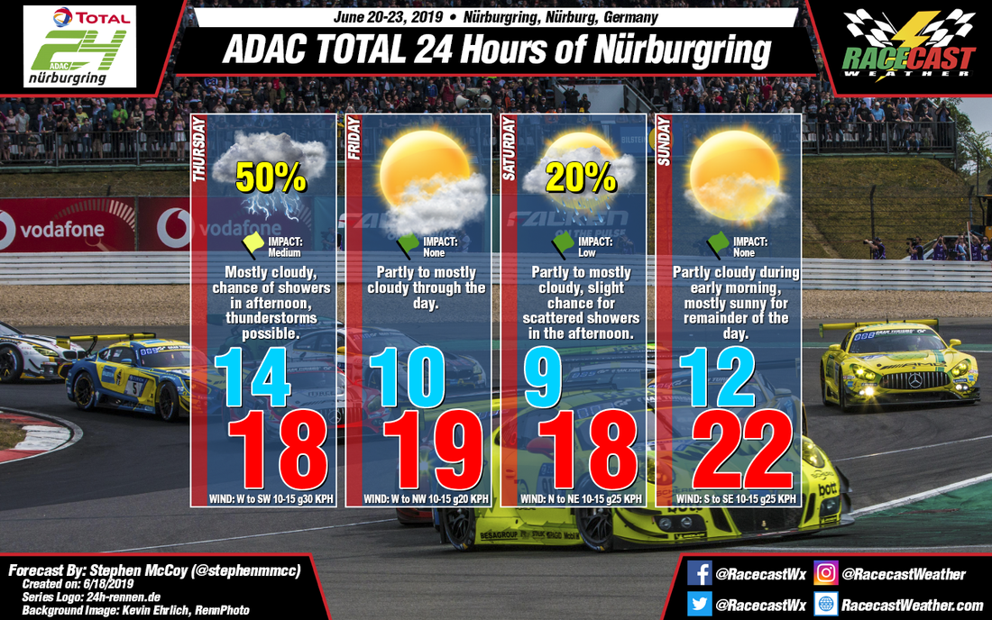

Precipitation remains in the forecast for Thursday with a chance for showers in the afternoon with thunderstorms possible. Friday and Saturday are relatively unchanged and Sunday's conditions have improved since the initial forecast.
A cold front from a low pressure system moving northeast towards Scandinavia will pass through the region Wednesday afternoon to overnight; rain and thunderstorms are likely ahead of the front as convective atmospheric potential energy (CAPE) values approach 1500 J/kg. After the front passes, surface winds will remain from the west to southwest while low level winds continue from the southwest. Saturated air in the low levels will lead to mostly cloudy skies through the day and eventually showers in the afternoon with thunderstorms possible.
Much like the initial forecast, Friday's conditions will be dry with partly to mostly cloudy skies likely through the day as high pressure begins to build in over the region from the west. On Saturday, the high pressure system will move to the north of the region, shifting winds to the north to northeast, which will cause some slightly cooler temperatures for the day. Model output has shown a surface low pressure system forming over the Mediterranean Sea off the west coast of Italy and moving to the east to northeast during the morning. Should the low track more northward, it could bring a slight chance for scattered showers in the afternoon, however recent model runs have the system remaining to the south which will leave conditions dry at the track.
On Sunday, the aforementioned surface high will bring drier air to the region as winds shift to the east to southeast. Winds in the low levels also from the east to southeast will result in partly cloudy conditions through the morning with mostly sunny skies for the remainder of the day. Less cloud cover and potentially southeasterly winds will lead to warmer conditions.


