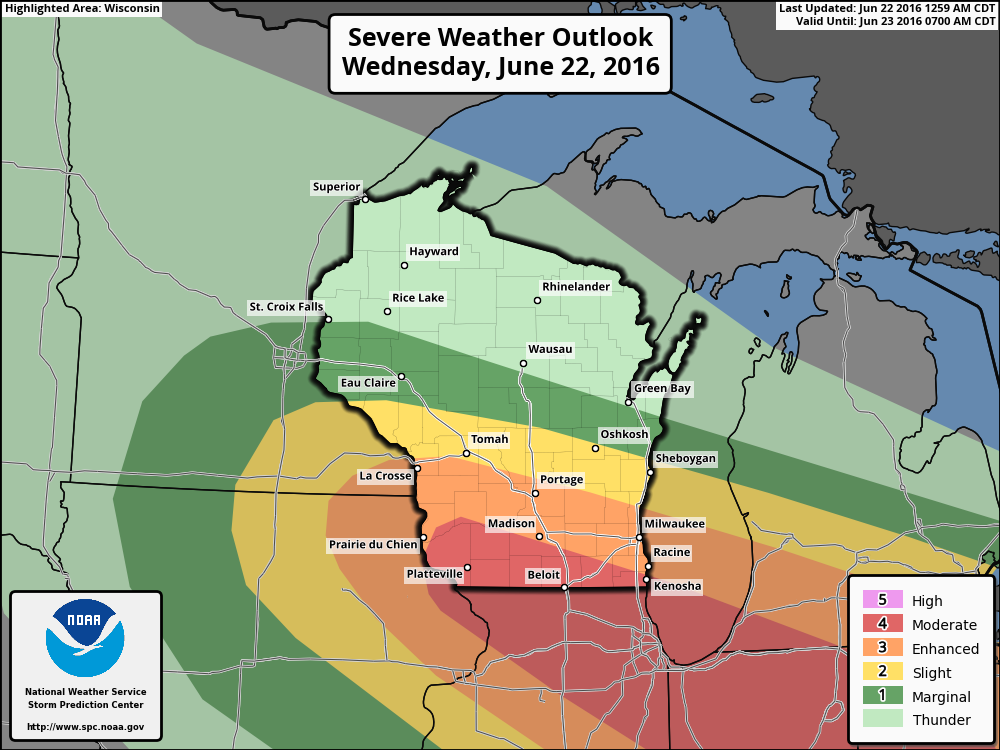
Looking at the latest run of the HRRR Simulated Radar, showers and thunderstorms will start to move through the area. These will be below severe limits. With this model run, a derecho forms around the 5PM hour across southern Wisconsin and moves quickly off to the southeast. Good news with this run is that the strongest part of the storm will be south of the track. Instability values will be well below numbers to support severe storm formation, and Significant Tornado Parameters will be at 0.
It looks like Road America will be dodging a bullet for today, but there could be a "fly in the ointment." If the low is 25 to 50 miles more northward when it moves across this afternoon, the severe threat will be greatly increased as the more unstable air would be in the area. I'll have radar up and running today so you can keep up to date with approaching storms and warnings. Main threat today will be damaging winds, large hail, and a few tornadoes. Please stay weather aware as this could be a serious situation if it moves north of the forecast.
On Friday, mid-level ridging will be in control of the weather, and great weather will be expected. Sunny skies and warm, with daytime highs near 80. Winds will shift during the morning starting off out of the west then out of the south before noon.
On Saturday, the ridging starts to shift to the east and moisture levels will start to rise. This will be an increase in instability to the area during the peak of daytime heating, and there is a slight chance for an afternoon or evening isolated shower or storm to develop. Otherwise, mostly sunny skies and warm, with afternoon highs in the low to mid 80s.
A surface low will drag a prefontal trough across the area for Sunday, and this will bring in a decent chance for showers and storms. There is some agreement in the models that has the precipitation diminishing during the afternoon hours. Otherwise, skies will me mostly sunny and afternoon highs will be in the mid 80s.


