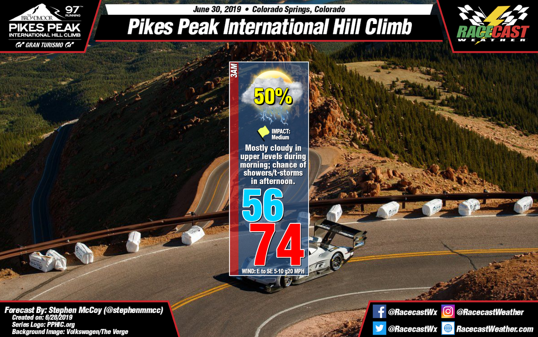
The atmospheric set-up hasn't varied much from the initial forecast as upper level winds will be from the southwest ahead of an upper level trough. Moisture in the upper levels is expected to cause some partly to mostly cloudy conditions on Sunday morning to mid-day. An area of low pressure is anticipated to form to the eastern side of the Rockies during the day. Cyclonic rotation around the low will result in winds from the east to southeast which will transport air from the Great Plains to the region. Orographic lifting will cause the air to condense as it moves up the mountainous terrain, allowing scattered showers to occur through the region, with some thunderstorms possible. As I mentioned in the initial forecast, the conditions discussed here are for the start line of the hill climb, so conditions could vary at the top of the mountain, namely temperature, cloud cover, and precipitation.
|
By: Stephen McCoy Conditions haven't changed much since the initial forecast for Sunday with minor changes in temperatures and no changes to the winds in this update. However, chances for showers are increasing for mid-day Sunday into the afternoon. Recent model runs have been in agreement with each other; all global models indicate some amount of precipitation occurring during the day. The NAM 3km model, which is a higher resolution model and can model the terrain better, doesn't help the case for dry conditions: CAPE values are approaching 1000 J/kg which will help to create unstable conditions for the region.
The atmospheric set-up hasn't varied much from the initial forecast as upper level winds will be from the southwest ahead of an upper level trough. Moisture in the upper levels is expected to cause some partly to mostly cloudy conditions on Sunday morning to mid-day. An area of low pressure is anticipated to form to the eastern side of the Rockies during the day. Cyclonic rotation around the low will result in winds from the east to southeast which will transport air from the Great Plains to the region. Orographic lifting will cause the air to condense as it moves up the mountainous terrain, allowing scattered showers to occur through the region, with some thunderstorms possible. As I mentioned in the initial forecast, the conditions discussed here are for the start line of the hill climb, so conditions could vary at the top of the mountain, namely temperature, cloud cover, and precipitation. |
Social Feeds
Authors
Doug Schneider Partners
Categories
All
Archives
December 2023
|


