
By: Stephen McCoy
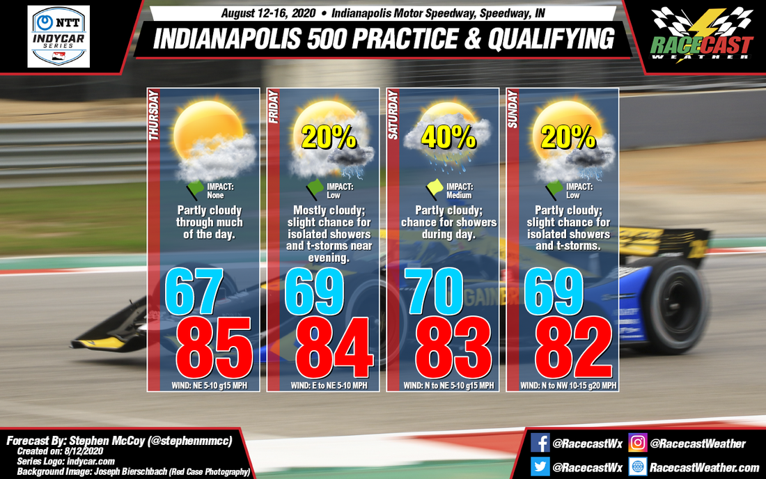
Precipitation chances have diminished somewhat for the remaining practice days for the Indianapolis 500. Otherwise, conditions are staying mostly as-expected from Monday's initial forecast.
For Thursday and Friday, a surface high pressure system currently located over the Great Lakes region is expected to move towards the northeast into eastern Canada by Friday evening. The anticyclonic rotation around the high will cause surface winds mainly from the northeast each day, with a slight change to the east during the second half of Friday. A temperature inversion in the low levels of the atmosphere will inhibit convective development on Thursday and resulting in partly cloudy conditions for much of the day. Low level winds from the east/northeast on Friday will erode the inversion and allow for a slight chance for afternoon showers and/or thunderstorms around the region.
For Saturday and Sunday, an upper level low pressure trough will develop over the Missouri River Valley during Friday afternoon and into the overnight. The trough will cause a surface low pressure system to form over Tennessee/Kentucky and push northeastward through the weekend. Moisture in the lower levels will bring a chance for showers during Saturday as the low passes to the east of central Indiana. As the system continues its movement towards New England, winds in the region will shift to the north to northwest, possibly resulting in some slightly cooler temperatures, though model guidance shows uncertainty in the maximum on Sunday.


