
By Doug Schneider - @Race4caster
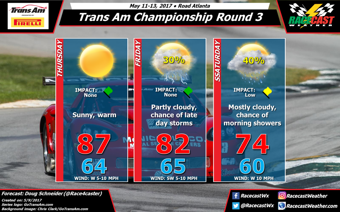
Road Atlanta will host the third round of the Trans Am Championship this weekend, and although the forecast graphic has a chance of shower and storms mentioned on two out of the three days, I don't expect that the weather will be too bad for racing.
A large high pressure ridge will be over the Southeast on Thursday, which will provide sunny skies and warm temperatures. Highs will reach the upper 80s, with no chance of rain.
The high pressure ridge will give way on Friday as a low pressure system approaches from the northwest. Friday will start off mostly sunny, but clouds will be increasing through the afternoon. There are some timing differences in the models right now regarding the time that showers and storms could arrive, but I think the most likely time is after 3 pm - after on-track activities have ended for the day. The weather impact on Friday is green, as the day's activities should go through with no problems.
There will likely be showers and thunderstorms on Friday night as the cold front associated with the low pressure system moves through. Around a quarter inch of rain will be possible Friday night. But the upper level trough will drag behind the front, which could keep some scattered showers going into Saturday morning. The TA/TA3/TA4 race begins at 8:55 am, and there is a chance that it will be affected by rain. I could see a wet start to the race, or perhaps a delay to the race, so I have a yellow flag for low impact. Any rain on Saturday morning should be light, just a tenth of an inch or less. Conditions will be improving through the day, and there could be some sunshine breaking through in the afternoon.
I plan on having another forecast update posted either Thursday or Friday, depending on how much the outlook changes.


