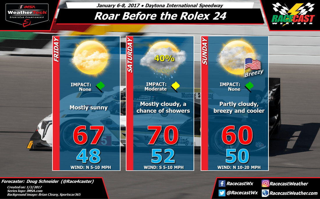
My confidence in this forecast is on the low side, because the models have not been in good agreement on the pattern across the United States for the coming weekend, and there have been big changes from one model run to the next. This forecast is a compromise between models that are showing very different timing of rain, but it is the scenario that appears most likely to happen at this time.
After Friday is when the models really disagree on the timing of a low pressure system moving across the Southeast. One shows rain arriving as early as Friday evening, while another is about 24 hours slower, bringing in rain on Saturday evening. With a lot of uncertainty, I will make a middle-of-the-road forecast between the two extremes, and have a chance of rain during the day on Saturday. Stay tuned to later forecast updates for better refinement of the timing of the rain chances.
I expect that any chance of rain will be gone by Sunday morning as the models place the cold front off the Florida coast by this time. Behind the front, there will be cooler temperatures in the 50s, along with a stiff northerly breeze of 10 to 20 mph, with some higher gusts at times.
Thanks to Scott for creating the new forecast graphic. Notice that we have the new impact indicators on the forecast - you can learn more about what they mean here.


