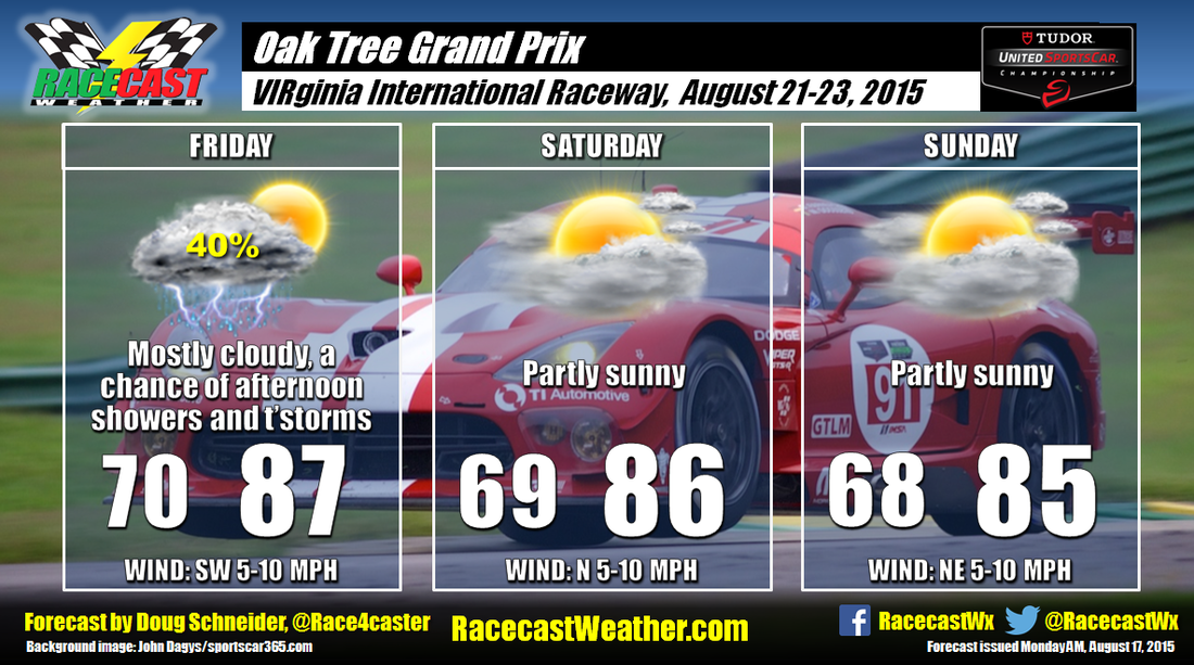
The general weather pattern toward the end of the week will be a low pressure system tracking northeast across the Great Lakes region, with high pressure over the western Atlantic Ocean. This pattern will supply a southwest flow of moisture across the southeast United States Thursday and Friday, and bring a chance of afternoon showers and thunderstorms. I have the most confidence in this part of the forecast.
For Saturday and Sunday, my confidence decreases as the models show some different scenarios. Right now, I favor a scenario in which the high pressure over the Atlantic will build westward, and this will suppress the chance of showers and thunderstorms over the weekend. If the ridge does not build west, then the flow of moisture from the Gulf of Mexico will continue, and there will be a chance of afternoon showers and thunderstorms Saturday and Sunday.
I'll be at the race Saturday and Sunday, and it would be great to meet you. I'll probably be wearing an NC State shirt or hat both days.


