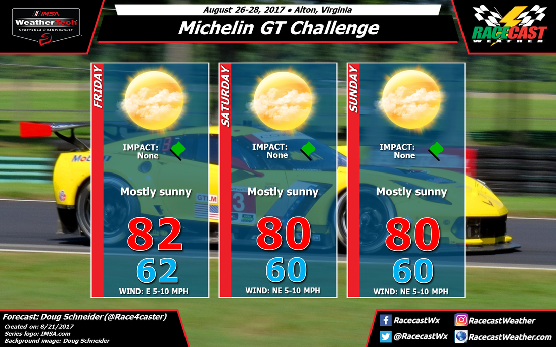
A cold front is expected to move through the area on Wednesday night, which will bring some storms. Behind it, a large area of high pressure at the surface will be tracking across the Great Lakes and into New England through the weekend, and extend southward along the east coast. In the upper levels of the atmosphere, there will be a trough located near the coastline, producing a northwesterly flow aloft. The upshot of these features will be dry weather with plenty of sunshine, temperatures cooler than normal, and comfortable humidity levels.
There is one caveat to this forecast that I have to mention. One model (the GFS) does produce some afternoon showers each day, mostly near the mountains to the west, but it does show some precipitation reaching the track. My experience with this model is that it sometimes overplays the chance of afternoon showers in the summertime. Other models and the forecast from the NWS favor a dry weekend. At this time, I'm going with a dry forecast, expecting that this wetter model will change as we get closer to the weekend.


