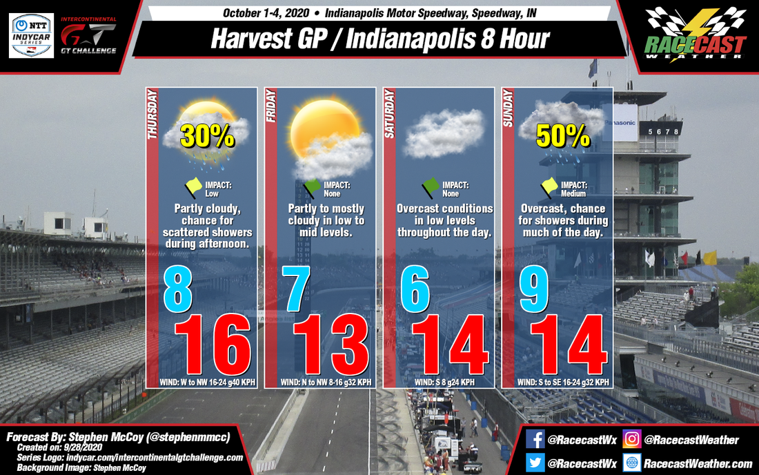
On Wednesday, a surface low pressure system will pass north of the Great Lakes as it tracks eastward towards the Atlantic Ocean. A trailing cold front will move through Indiana during this time period, setting up cooler temperatures for the region in the following days. West to northwesterly winds overnight Wednesday and into Thursday will result in morning low temperatures in the upper 40's °F and a high in the low 60's °F as the winds continue through the day. Behind the front, there is the possibility of a surface trough extending westward through the Great Lakes region from the aforementioned surface low and moving southward into Indiana during the day. The movement of the trough could bring a chance for scattered showers to the Indianapolis region, especially during the afternoon and may impact the various on-track sessions during this time.
As the surface low continues towards the east coast, high pressure is expected to slowly build into the region over the first part of the weekend. With the center of the surface high to the west, winds on Friday will be largely from the north to northwest, accompanied by partly to mostly cloudy conditions in the low to mid levels for much of the day. The cooler temperatures will continue with a low similar to Thursday and a high in the mid 50's °F. The surface high is anticipated to move over the central Midwest Friday night into Saturday, resulting in calm and variable winds for most of the early part of the day before shifting to the south as the high moves eastward. The lack of wind movement will extend to the low levels of the atmosphere, causing mostly cloudy to overcast conditions; temperatures will be similar to Friday.
Leading up to Sunday, an upper level shortwave trough will allow a low pressure system to develop at the surface over the northern Plains late Friday evening. Due to the trough's orientation, the surface low is expected to track southeastward, centering itself over Illinois on Sunday. Current model output disputes the exact location of the low, but general consensus indicates the center of the system will be either to the west or southwest of Indiana. As a result, a warm front will likely extend from the low somewhere over central Indiana; model output shows a disparity in the low temperature for Sunday as a result of the front, with a range of 10 °F in the most recent runs. In any case, the system is expected to bring a chance for precipitation and overcast skies through much of the day.


