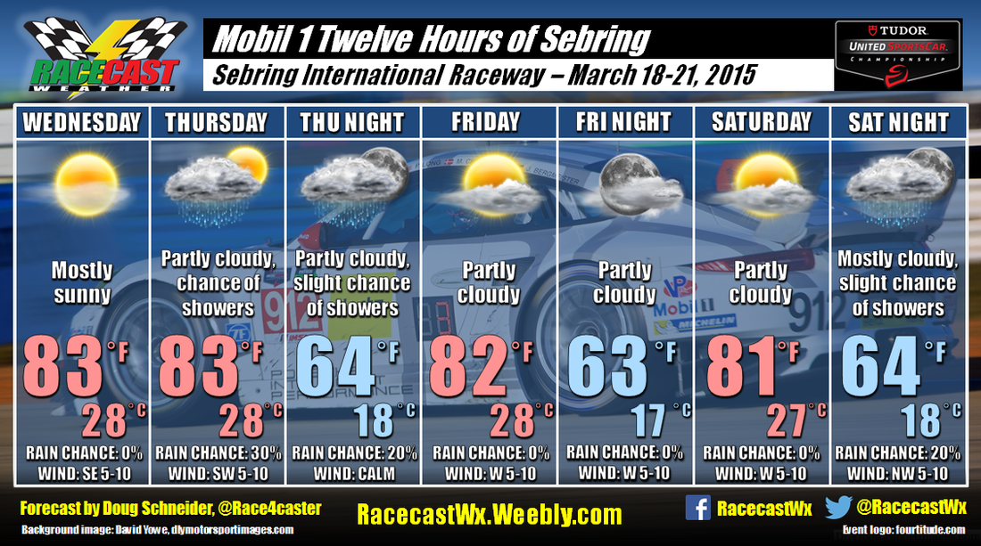
A ridge of high pressure will be over Florida to start the event on Wednesday, but the ridge breaks down on Thursday as a weak upper level trough moves over the region. This may allow a chance of showers, mainly in the afternoon and evening. The drier ECMWF model shows a weak ridge building back over the area for Friday and Saturday before a low pressure system approaches from the west on Sunday. The GFS model does not show as much of a ridge, and is faster to bring in the next low pressure system. If this occurs, there would be a higher chance of rain on Saturday. For now, I'm leaning toward the drier forecast because the ECMWF has been the more consistent of the two models - each run of the GFS seems to switch back and forth on the rain chances. In either case, temperatures look pleasant each day, with highs in the lower 80s.
For forecast updates through the week, follow the @RacecastWx and @Race4caster Twitter feeds.


