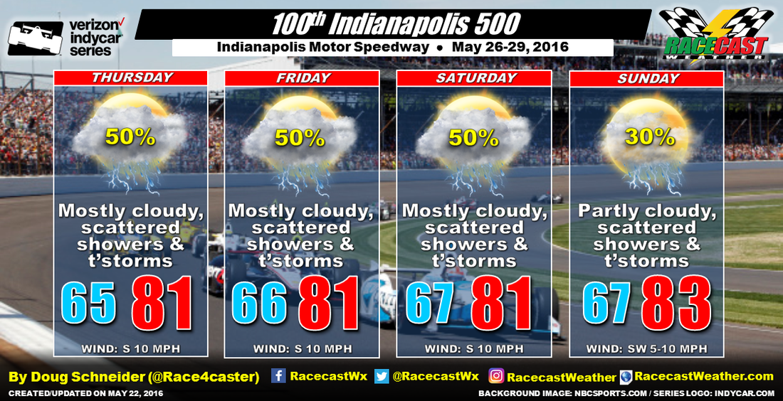
The pattern across the eastern half of the United States will feature high pressure off the Southeast coast and low pressure over the Plains. This will produce a southerly flow of moisture from the Gulf of Mexico toward Indiana. The abundant moisture along with afternoon heating will generate scattered showers and thunderstorms. This pattern is expected to persist and not change very much through race weekend, so there will be a chance of showers and thunderstorms at the Speedway everyday. I've been monitoring the weather models over the past few days, and they generally agree on this pattern, and have been consistent from one model run to the next. So I have medium confidence in this forecast.
There is some good news in this forecast - there isn't a strong low pressure system or front tracking across the area that will make any particular day a complete washout. Pinning down a specific time that is favored for rain is difficult this far out, but I think that the afternoons will be the favored time for showers due to heating creating some instability. It looks more like a passing shower or thunderstorm will be possible at times that will wet the Speedway and move on.
Another piece of good news is that Sunday appears to have the lowest chances of showers, as the high pressure area off the Southeast coast is expected to build a little toward the west. This may push the Gulf moisture westward and keep most of the showers west of Indiana, so I have a lower rain chance on Sunday than the other days. With the pattern changing very little, high temperatures are expected to be in the lower 80s each day. Winds will be from the south to southwest around 10 mph each day.
I plan on making a video briefing for the forecast update on Tuesday.


