
By Doug Schneider
The weather pattern across Indiana this weekend will start off with favorable conditions for qualifying on Saturday, but as a front approaches the area on Sunday, the chance of rain will increase and possibly threaten the on-track activity.
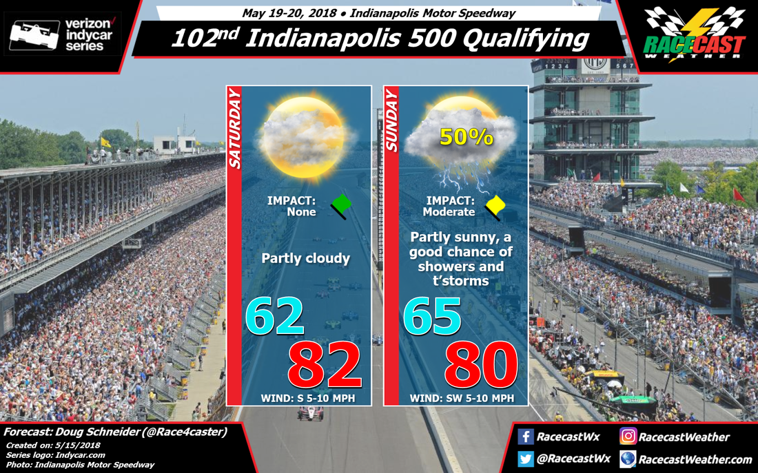
A low pressure system is expected to be east of the area on Saturday, with a high pressure ridge extending over the Ohio Valley region that will likely provide a dry day as qualifying begins. With partly cloudy skies, high temperatures should reach into the lower 80s in the afternoon. South winds will be fairly light and have little impact on the speeds.
The high pressure ridge will be suppressed southward by a trough and cold front that will be approaching from the north on Sunday. With the front expected to be somewhere in the vicinity of Indianapolis on Sunday, I have to include a 50% chance of showers and thunderstorms. Timing and speed of the front remains uncertain this far out in the forecast, so at this time I can't pinpoint a time of day when rain chances are favored. I put the Impact at a yellow flag, which means that there may be some interruption of on-track activity but qualifying should be able to be completed. At this time, it does not appear to be a long-lived soaking rainfall that would cause cancellations - on/off scattered showers seem more likely with this pattern. But rain amounts and timing should start to come into better focus over the next few days.


