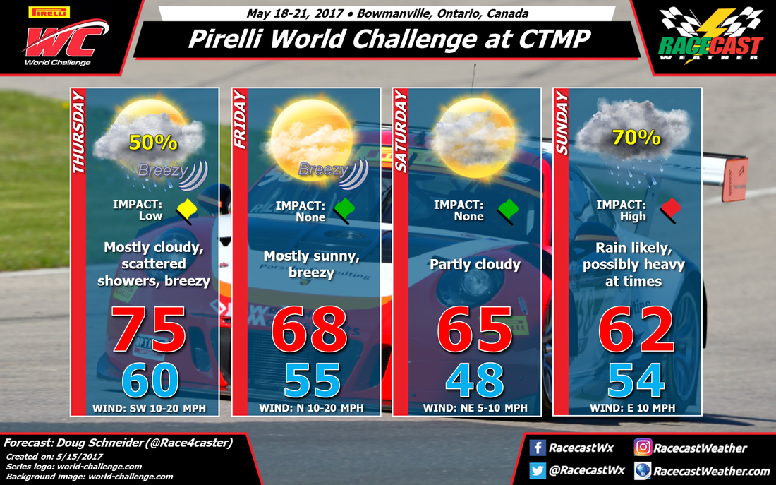
The first low pressure system will move across the upper Great Lakes and central Ontario on Thursday, This will bring scattered showers to the area around the track through the day. There will also be a good southwest wind at 10 to 20 mph all day, which will help temperatures warm up into the 70s.
The cold front associated with the low will cross the area and settle to the south on Thursday night, which will bring an end to the rain chances and usher in some cooler and drier. air. Friday looks like a beautiful day at the track, with a high in the upper 60s and mostly sunny skies. Winds will shift to the north behind the front, and it will still be breezy.
Saturday should continue to have nice weather as high pressure moves east across Ontario, with some increasing clouds ahead of the next low pressure system. It looks like any chance of rain will hold off until after dark.
Sunday isn't looking good right now. For the past few days, the models have been showing a low pressure system that will track east across the Great Lakes during the day. As a result, the front that moved through on Thursday night will lift back to the north as a warm front, which will produce a high chance of rain on Sunday. The models are in pretty good agreement with this scenario, so I have a 70% rain chance on Sunday. There is a good southwesterly flow of moisture up and over this warm front, so it appears that rain amounts could be pretty high, with heavy rainfall possible at times. This is why I have a high impact on Sunday - if the current models hold up, I could see some significant delays or cancellations to the races.
I'll have a better idea of potential rain amounts in the next few days, so stay tuned for updates.


