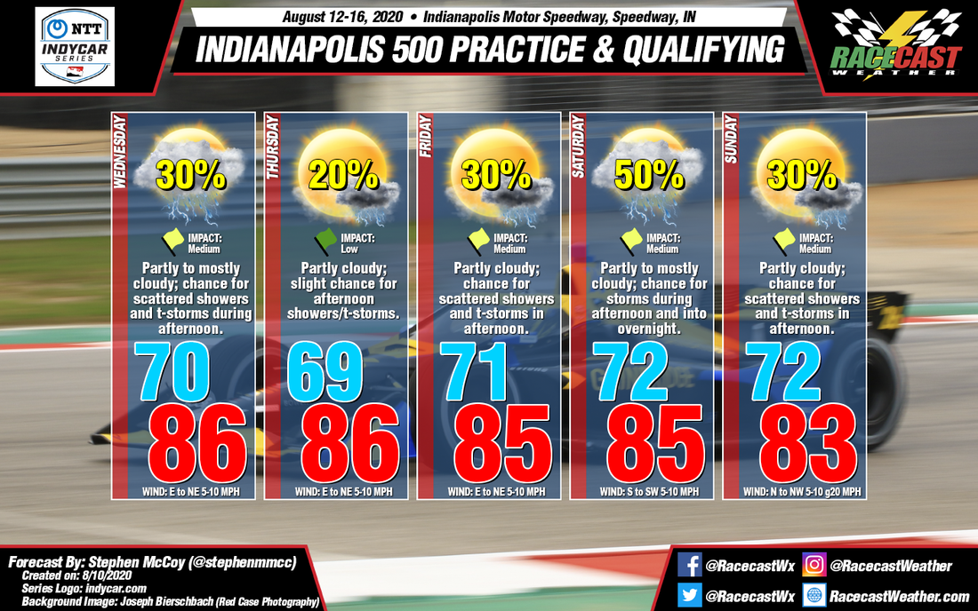
For Wednesday through Friday, an upper level ridge over the southwestern US will influence a high pressure system at the surface, moving it northeastward through the Great Lakes region. For much of the time period, surface winds will be relatively light from the east to northeast, accompanied by partly cloudy skies. Dew point temperatures in the mid 60's could give enough convective inhibition to result in isolated to scattered showers and thunderstorms in the afternoon around the area.
For Saturday and Sunday, conditions are anticipated to be similar to those earlier in the week, however towards early Saturday afternoon, a cold front will move eastward through central Indiana, bringing with it an increased chance for precipitation, with the greatest chance occurring in the overnight hours. Winds during the day will be from the south to southwest with partly to mostly cloudy skies. After the front passes through, winds will shift towards the north to northwest for Sunday, accompanied by clearer conditions. Much like earlier in the week, a slight chance for showers and thunderstorms is present during the afternoon.


