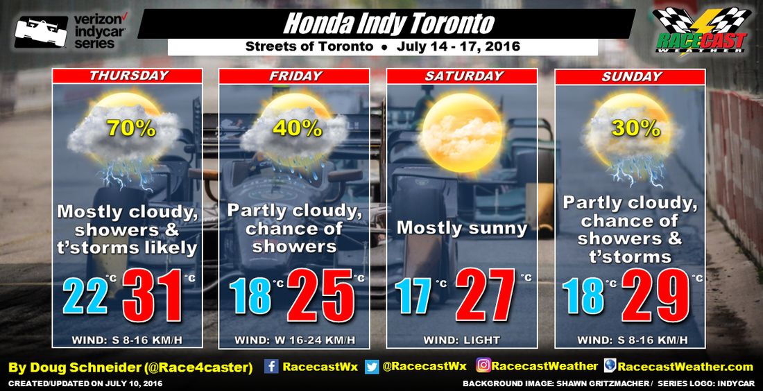
What happens behind the front is much less certain. The GFS model quickly takes the rain to the east, as it has a much weaker upper level trough, and it shows Friday being a beautiful day. Other models (ECMWF and CMC) have a deeper and slower upper trough that brings another shot of rain on Friday. As a compromise, I am going with a chance of rain on Friday.
Saturday appears to have the best chance of dry and sunny weather as high pressure builds across the Great Lakes region. But there is still some uncertainty as the GFS model shows a weak upper level disturbance quickly passing overhead. But I'm skeptical of the GFS as it has not been consistent from one run to the next. So I am leaning toward a dry forecast on Saturday, and see how the models change over the next few days.
Sunday is a big question mark as the model disagreement continues. The ECMWF model shows the high pressure area moving east of Toronto, and more moisture beginning to spread into the area again. There could be a chance of showers and thunderstorms, but again, my confidence is low and I expect this forecast to change through the week.
Apologies for boring you by talking about models so much in this post.


