
By Doug Schneider
 Click to enlarge | 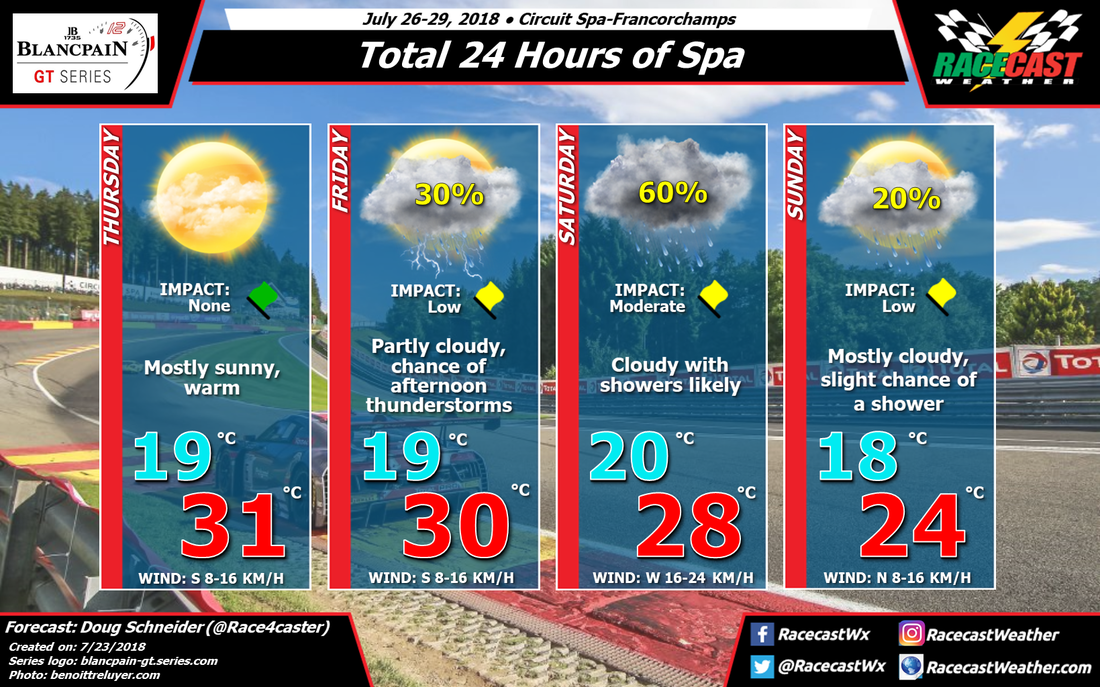 Click to enlarge |
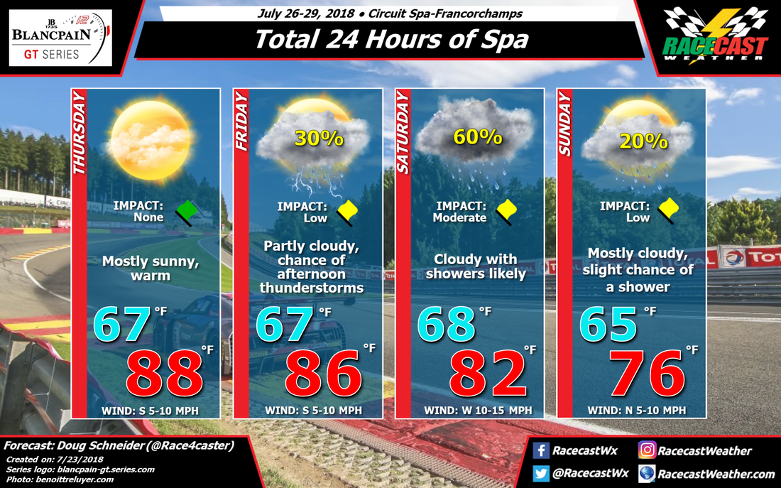
The second race of the Intercontinental GT Challenge and the fourth of the Blancpain GT Series Endurance Cup will be at Spa-Francorchamps this weekend for the 24 Hours of Spa. Weather conditions could be mixed through the weekend, with the main period of rain expected to be on Saturday.
The event will open with a high pressure ridge over France and Belgium on Thursday that will provide mostly sunny skies and warm temperatures at Spa-Francorchamps. Temperatures on Thursday will reach the upper 80s F and lower 30s C. This ridge will shift to the east on Friday, becoming positioned over Germany, while a low pressure system will be over the northern Atlantic, west of Ireland. Warm temperatures will continue, but with a little more moisture and instability expected, scattered showers and thunderstorms may develop in the afternoon.
The low pressure system over the Atlantic will rotate toward the east and extend across Great Britain and northern France on Saturday. With Belgium on the east side of this trough axis, moisture and lift will generate rain showers across much of the region. There are some uncertainties about the timing of the best rain chances, and it is possible that most of the rain could fall on Friday night. But there is enough model agreement for a 60% chance of rain on Saturday. Rain amounts are too uncertain to specify this far out.
With some timing uncertainties about the speed of the upper trough, I have to keep a slight chance of showers going into Sunday. One model in particular shows most of the rain coming on Sunday, although most show the rain exiting by Saturday night. I think that most of Sunday will have dry conditions, with some breaks in the clouds now and then. With the upper trough expected to be east of the area, winds will turn to the north and temperatures will be cooler, with highs in the mid 70s F and mid 20s C.
Check back through the week for forecast updates.


