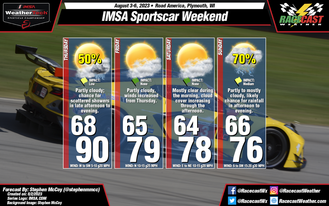
Once this front moves through, an area of high pressure will build in, shifting winds more towards the North. As a result, temperatures for Friday and Saturday will be expected closer to normal. Partly cloudy conditions will persist for much of this time period, mostly in the mid-to-upper levels as the result of an area of low pressure located over the Great Plains. Cloud cover will increase Saturday afternoon as the low begins to move into the Midwest.
The low pressure system will make its way over central Wisconsin on Sunday. Winds are likely to increase to 15-20 mph sustained with gusts approaching 30 mph out of the South/Southeast. A warm front will extend to the East from the center of the low, though the front will remain to the South of the track, which will keep temperatures a few degrees below normal, and the afternoon high the coolest of the weekend. There is a likely chance for showers and thunderstorms associated with the system, which is expected during Sunday afternoon; however exact timing of the rainfall is still a bit uncertain. What is somewhat certain is that if rainfall occurs during Sunday's race, it will likely be a full wet race, as the forecast models predict an average rainfall total around 1/2" for the day.


