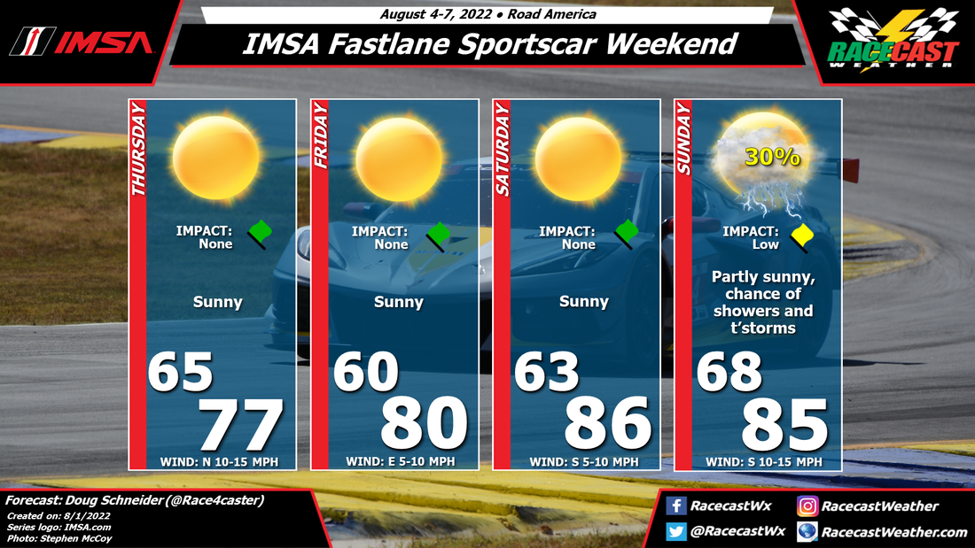
A cold front will pass through Wisconsin on Wednesday night, and a high pressure system building in behind it will provide beautiful weather on Thursday as practice sessions begin. This high will gradually shift east through Friday and Saturday, which will result in a southerly wind developing that will bring warming temperatures each day. As a warm and moist air mass builds over the weekend, the chance of showers and thunderstorms will increase as a cold front approaches the area on Sunday. The timing on the chance of storms is too uncertain to pinpoint this far out, but that should come into better focus later in the week. Right now, it appears coverage will be scattered with Low impacts, and it won't be a wash-out. Check back for updates through the week.


