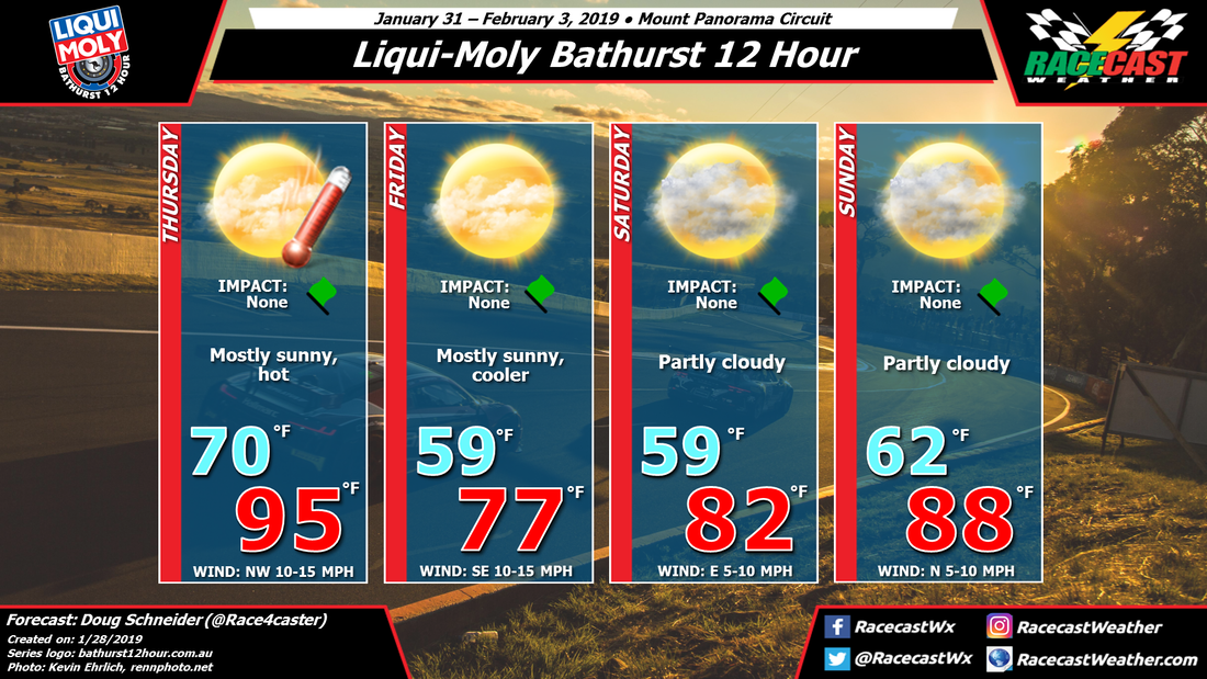
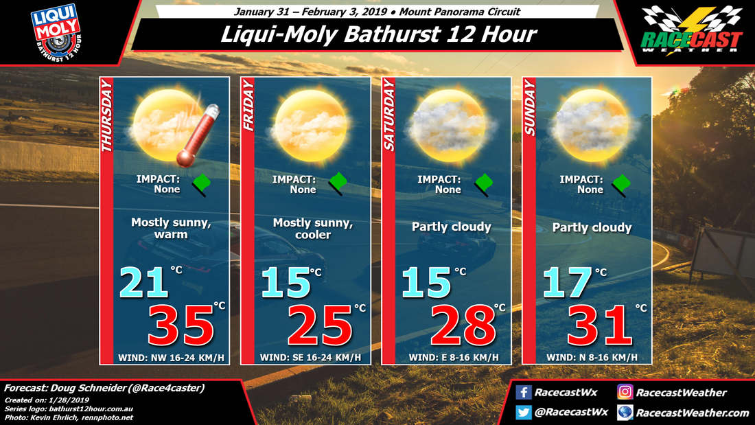
Thursday will open with warm temperatures in the mid 30s C/ mid 90s F. Then a cold front will pass through the area Thursday night, which will shift winds around to the south. There will not be enough moisture with the front to produce any precipitation.
High pressure off the southern Australia coast will be building into New South Wales on Friday, and with it will come cooler temperatures and a southeast wind. This high will be drifting east across Tasmania and toward New Zealand through the weekend. As it does, winds will shift back around to a northerly direction, bringing a gradual warming trend each day. By Sunday afternoon for the end of the race, temperatures will be back over 30 C.
One thing to keep an eye on will be the potential for afternoon showers to pop up on Sunday. At this time it seems unlikely, but with warming temperatures and a little more moisture, it can't be ruled out entirely. I'm going with a dry forecast for now, but stay tuned for updates later in the week.


