
By Doug Schneider
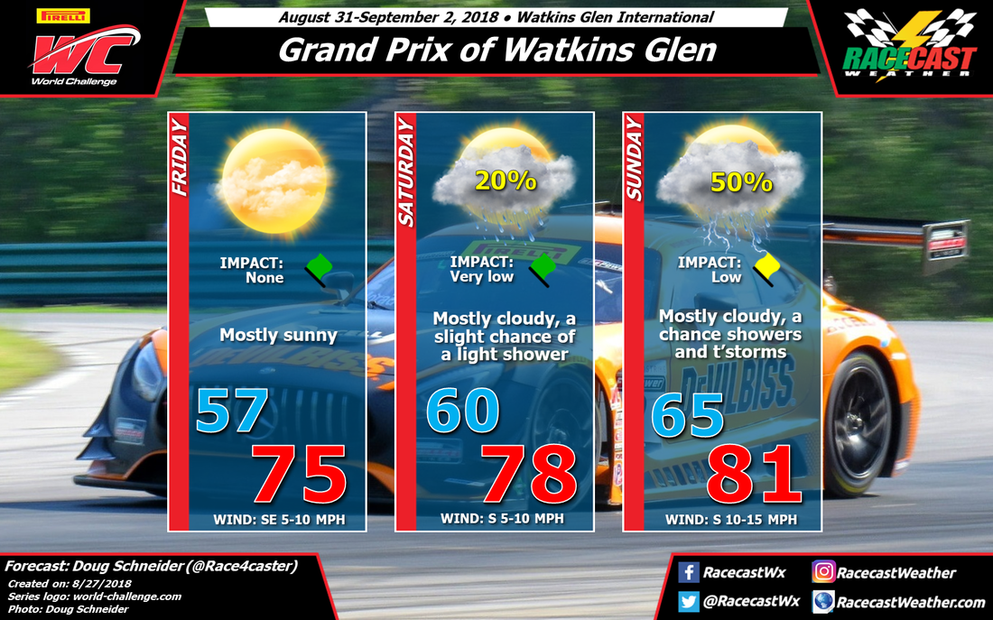
The start of PWC's weekend at Watkins Glen will have really nice weather, but as a low pressure system approaches, the chance of rain will rise through Sunday.
A large area of high pressure will be over Quebec on Friday, extending south into New York. It will supply dry and stable air into the Finger Lakes region, as well as pleasant afternoon temperatures in the mid 70s and low humidity.
As the high continues its eastward track, winds will turn to a more southerly direction, which will start to increase the amount of moisture in the low levels of the atmosphere on Saturday. With more moisture comes more instability, and there could be a few isolated showers around on Saturday, mainly in the afternoon. If showers do form they will likely be light and brief, so the chance of rain impacting the racing is very low on Saturday.
A low pressure system will be tracking across the Great Lakes region on Saturday night and Sunday, which will strengthen the southerly flow of moisture into upstate New York. Showers will be more numerous ahead of a cold front that will be trailing south of the low, and a few thunderstorms could be possible. The big question is timing, and at this point we are too far out to pinpoint that with any confidence. That should come into better focus with later forecast updates.


